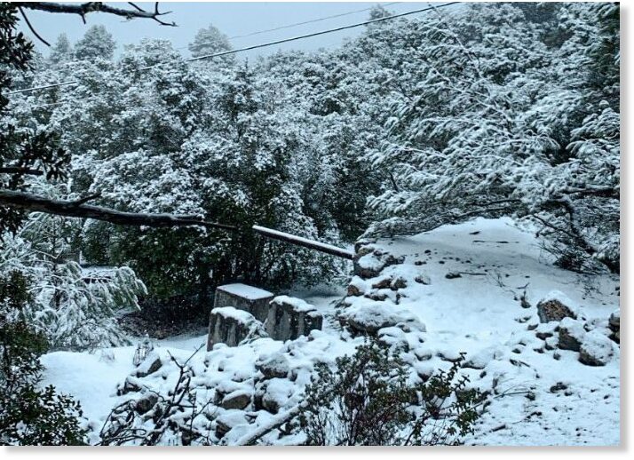
The Ice Age Cometh! Forget Global Warming!

'This week’s expected storm system should be colder and produce more snowpack. Significant flooding from local rivers and creeks throughout the state should continue for the next several days, along with strong winds, officials said.'
 
A burst water main leaked into a bush in Staunton, near Gloucester. As the temperature dropped to lows of -10C, the icicles grew longer, transforming the bush into a "fairytale" sculpture.

_128029542_mediaitem128027973.jpg

_128028304_mediaitem128028189.jpg

_128029546_mediaitem128027971.jpg


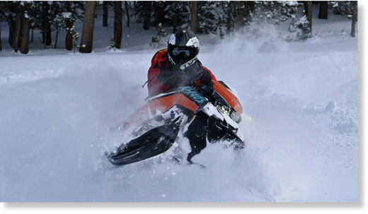
Mammoth Mountain ski resort in California closed due to too much snow - 13 FEET in just 9 DAYS since start of year​


DEEP!
© Patrick Griley/Mammoth Lakes Tourism
DEEP!


Thanks to continued snowfall, Mammoth Mountain, CA, has reported 40 - 54 inches from this current storm with an expected snow accumulation of 22 -28 inches today.

Mammoth Mountain has surpassed last year's season snowfall total and, with 419″ of fresh snow at the summit, is now officially the snowiest ski area on Earth. 310 inches have dropped at the Main Lodge, including 13 feet since January 1. The resort also has the deepest base in the country.

Mammoth has been closed today due to the intense snowfall conditions and very dangerous travel in the area. Roads have been heavily impacted and are not plowed. The resort will focus on avalanche mitigation work today and protecting our equipment. They plan to reopen tomorrow, January 11.

mmmmmmmmm
© Patrick Griley/Mammoth Lakes Tourism
mmmmmmmm
© Patrick Griley/Mammoth Lakes Tourism
mmmmmmmmm
© Patrick Griley/Mammoth Lakes Tourism
mmmmmmm
© Patrick Griley/Mammoth Lakes Tourism
 
The Article includes numerous pictures of the losing narrative of global warming.

Meanwhile, the temps here dipped to a sudden -8.889°C within just 30 hrs from Friday
PS, no snow in the ground here just copious amounts of nonstop rain.

Heavy snowfall in progress on La Mongie +35cm

Video 👀
TRAVEL chaos is set to hit today as snow blankets parts of Britain during a freezing -10 Arctic blast.

And it's only the beginning - with more warnings already placed over parts of the UK for this week.
Screenshot 2023-01-16 at 17-31-43 Travel chaos as snow hits in freezing -10C blast - with more...pngScreenshot 2023-01-16 at 17-32-30 Travel chaos as snow hits in freezing -10C blast - with more...png
Snow started falling across the country overnight, with Brits waking to their cars and roads already covered.

Photos snapped in Kent and Essex this morning showed the white stuff blanketing streets.

The Met Office has said overnight sleet will leave behind slippery surfaces which could cause "injuries from slips and falls" and "icy patches on some untreated roads, pavements and cycle paths".

It comes after the forecaster placed yellow ice and snow warnings over much of the UK.

Meteorologists issued snow warnings for Brighton, Chichester, Canterbury and Dover between 2am and 8am this morning.

Scotland should brace for snow and ice with a yellow weather warning also issued for the south.

Ice alerts included parts of Northern Ireland, Northern England, Northern Wales and the Midlands.

Forecasters have also said the weather is expected to cause travel chaos throughout.

They said commuters should be prepared for disruption to plans with delayed or cancelled rail and air travel.

This morning forecasters added another snow and ice warning for Northern Ireland, Northwest England, and North Wales.

The warning is in place for 24 hours from midday today, with five to 10 centimetres of snow possible over higher ground.

The weather experts had predicted the icy conditions would start hitting across the UK from last night.

The mercury is set to fall as low as -2C in London, while temperatures could dip to -1C in Cardiff.

Edinburgh and Belfast residents are expected to feel the brunt of -3C conditions, while parts of the Scottish Highlands are set to see -10C.

Temperatures are also set to dip to -4C tomorrow in Kendal, Cumbria, and Dumfries in Scotland, Met Office maps show.

Scotland's yellow snow and ice warning is in place for almost three days after starting at 2pm yesterday and running until 10am on Wednesday.

The meteorologists' five-day forecast suggests the weather will be "turning colder with increasingly wintry showers from the north".

It expects further snow showers to fall in the north tonight with a widespread frost.

And from tomorrow it will be cold, particularly in the north, with some sharp overnight frosts throughout the week.

A warning for ice covering much of Scotland and the north-west and north-east of England suggests there could be "icy surfaces and high-ground snow leading to some difficult travelling conditions in places" this morning.

Expected "frequent wintry" snow showers have also seen the Met Office issue a lengthy warning for snow and ice for northern Scotland from today through to Wednesday.

The Met Office said: "A few centimetres of snow are likely at low levels over a given 24-hour period, with the potential for 10-15cm above 200 metres, especially across parts of the Highlands. Ice will be additional hazard, especially Tuesday night."

Residents are urged to take care as there may be some icy patches on some untreated roads, pavements and cycle paths and some roads and railways are likely to be affected with longer journey times by road, bus and train services.

The forecaster said: "By Sunday most of the UK will be in the northerly airflow, with lower temperatures spreading further south overnight.

"Showers will fall increasingly as sleet and snow in the north, even to lower levels.

"Some showers further South and West, and perhaps a more persistent spell of rain overnight into Monday, could also turn to sleet and snow mainly over high ground such as the Brecon Beacons, Exmoor and Dartmoor.

"Overnight frost will become more widespread by Monday night, with overnight temperatures below 0°C across much of the UK.

"Temperatures could get down to -10°C in sheltered glens, or across high ground areas of Scotland where there is lying snow."

The Met Office said that showers would continue on Sunday, "falling as snow in the north".

Large parts of Cumbria have already been covered ahead of a freezing week for the UK.

Snow ploughs were seen driving through the town on Nenthead to clear the roads on Sunday morning.

2023-york-uk-river-ouse-788875002.jpg

The River Ouse in York reached 4.14 metres last night flooding riverside roads and buildings Credit: LNP

Screenshot 2023-01-16 at 17-37-17 Travel chaos as snow hits in freezing -10C blast - with more...png


Screenshot 2023-01-16 at 17-51-27 Brenden Mincheff on Twitter.png
 
Last edited:
Milloy climate tweet sets Twitter abuzz; Even Musk admits he is no believer

This tweet has had 13 million views. Even Musk commented. The Twitter censors tried to ‘add context” but just showed what liars they are. Here’s my explanation and no-lose prediction for the CO2-warming hoax.

Here’s the tweet.

So here is the NOAA release

chrome_screenshot_1674045249572.png

After the release, I did the original tweet (above).

The next day and not unexpectedly, no one in the media reported that there had been no warming since 2015.

Screen-Shot-2023-01-16-at-11.24.23-AM-728x821.png

Screen-Shot-2023-01-16-at-11.26.29-AM-1-728x1111.png

Screen-Shot-2023-01-16-at-11.28.34-AM-728x584.png

And here’s the no lose part of my prediction:

  • If the El Nino steps up warming again followed by years of pause then prediction confirmed.
  • If the El Nino fails to step up warming, then CO2 warming is further debunked.
 
Creating a war against CO2, is to make war against life on earth.

_-2023-01-18-at-15.52.22.jpg


I bumped into this awesome site, called the CO2 Coalition - which among other things, collects many articles with graphs and shorter text masses, a wonderful collection to what climate change is, what it is not, and the many arguments against the lies of "Climate Change" by referring to honest science (often to the kind of studies which are generally suppressed by Gov, authorities and media) And of course, the many arguments which wants to make CO2 the main driver of Earth changes - are getting punctured. CO2 serves humanity and environment in so many ways....

that creating a war against CO2 is equivalent to wage war against life itself !

What i love with this site is, that it strikes a wonderful balance between information, graphs and not being too tedious (the latter which often tends to make you feel overwhelmed). But here, the arguments, illustrations, facts and references are just absolutely perfect aligned, to dive into the CO2 matter deeper without one's brain gets fried, or diffused by far too high level scientific writing.

Notice: The site can be a little slow. At least it is on my computer here in Stockholm with Safari and Brave browser.

CO2_3.jpg
 

Polar freeze in Spain brings temperatures of -15°C and snow in Ibiza


Mallorca
Snow in Mallorca

Temperatures of -15°C were recorded in one part of Spain during the current polar freeze and it even snowed on the Balearic island of Ibiza.

As confirmed by AEMET, the State Meteorological Agency, the Balearic island of Ibiza has met with unusual weather conditions thanks to the polar freeze currently affecting Spain.

This morning, Monday, January 23, residents of the town of Talaia de Sant Josep - located 475 metres above sea level - woke up to a blanket covering of snow. The town of Sant Joan de Labritja recorded -1.8°C overnight.


"We continue with very low temperatures and precipitation and with snowflakes at very low levels", announced AEMET. "It is usual in January, although it is not every year that we have cold as intense as this". This could even be accompanied by a storm and small amounts of hail they added.

According to AEMET, the lowest temperatures recorded overnight and so far today have been in the Pyrenees. In the Lleida town of Cal de Vaquera, it went as low as -15°C. Also in Lleida, Port Aine recorded 14.3°C. In Huesca, Cerler hit -13°C, and Astun with -12.9°C.

La Molina in Girona registered a minimum of -11.1ºC and in Granada's Sierra Nevada region temperatures fell to -10.7 ºC, according to AEMET data.

As of 7am this morning, a yellow warning was issued in the interior of the south of Valencia and in the interior of Alicante, where temperatures between -1ºC and -8ºC were registered. The alert will remain active until 9am tomorrow, Tuesday 24 due to extreme temperatures of between -3ºC and -4ºC can be expected.

Snowfall in the eastern Cantabrian and northern Iberian system and widespread frosts will predominate in practically all of Spain today say the experts. As a result, 12 autonomous communities have seen alerts issued for cold, wind, snow and high waves.

Specifically, yellow alerts are in place for Asturias, Avila, Burgos, Leon, Palencia, Salamanca, Segovia, Soria, Zamora, Albacete, Cuenca, Guadalajara, Toledo, Barcelona, Gerona, Tarragona, Teruel, Zaragoza, Madrid, Alicante and Navarra.

These are due to expected temperatures of between around -4v and -8ºC. Lleida and Huesca will be on orange alert for values close to -10ºC.

The Community of Madrid maintains the yellow warning for minimum temperatures in the entire region where thermometers could reach -6ºC in the Sierra area and -4ºC in the rest of the region tomorrow morning.

Snow will fall in the eastern Cantabrian and northern Iberian systems, more specifically, in Cantabria, Burgos, La Rioja, Alava, Guipuzcoa, Vizcaya, and Navarra.

In Mallorca, after a night of temperatures below zero, the Serra de Tramunta reached -2.3ºC. Snowfall of up to seven centimetres forced the closure of some sections of roads, the highest accumulation for five years.

As reported by the Insular Directorate of Highways, the Ma-10 from Km7 to 45 between Andratx-Pollenca, the Ma-2130 from Km6.5 to 14.99 between Caimari-Lluc, and the Ma-2141 in Sa Calobra were all closed.

Miquel Gili, the spokesman for AEMETS in the Balearic Islands informed Europa Press that the low temperatures could leave 'good snowfall' this Wednesday 25 in the north of Mallorca and the Serra de Tramuntana, in areas above 800m.
 
From ZeroHedge:

China's Northernmost City Sees Lowest Temperatures Ever Recorded

China's "North Pole" recorded its lowest temperature since records began.

The Chinese city of Mohe dropped to minus 53 degrees Celsius Sunday, according to China Daily, citing data from the country's local weather bureau.

The frigid temperatures broke a previous record of minus 52.3 degrees Celsius. Temperatures have been below minus 50 degrees Celsius for three consequence days.

"As a new round of extreme cold hit Heilongjiang, a number of areas in the Greater Khingan Range have recorded their coldest ever temperatures," China Daily said.
Earlier this month, we pointed out a cold air mass swirling in the Arctic was shattering records. The rural northern Siberian town of Zhilinda recorded temperatures of minus 62.1 degrees Celsius.

Arcfield Weather's Paul Dorian explained recently that winter isn't over and called for a significant change in North American weather.

On Monday, the weather blog Severe Weather Europe outlined:

The Polar Vortex is starting to weaken as a strong Stratospheric Warming event is about to unfold. As the forecast indicates, the Polar Vortex will be heavily deformed but will not fully collapse. These important events can have a significant impact on the rest of winter in the United States, Canada, and Europe.
Some meteorologists continue to tweet long-term weather models that suggest a polar vortex could result in colder weather for the US and Europe at the end of the month or early February.

READ MORE

After a 3 inch snow on Sunday, forecast to get 3 to 5 inches tonight through tomorrow in Columbus, Ohio. Temps have been low to mid 30s and above.
 
Another brave truther walks away from woke/fraudulent academia:

Rise Of Illiberalism: Professor Rails Against DEI, False Climate Narratives To Explain Exit From Major University

An earth science professor took to Twitter Monday to spell out how an increased push toward diversity, equity and inclusion (DEI) and “false climate emergency” narratives in academia resulted in his decision to leave the University of Alabama (UA).

Professor Matthew Wielicki announced he will leave his position in the Department of Geological Sciences at the end of the spring 2023 semester, according to his Twitter post. In addition to wanting to be closer to family, Wielicki, who calls himself a “classical liberal,” explained in a multi-post thread that a rise in DEI pushed him to leave his position.

“Furthermore, over the last decade or so, but especially the last few years, the obsession with universities and grant-funding institutions on immutable characteristics of faculty and students and the push for equity in science above all else has dramatically changed the profession of an academic professor,” Wielicki wrote. “The rise of illiberalism in the name of DEI is the antithesis of the principles that universities were founded on.”
[...]
Despite working to achieve a Ph.D from a young age, he felt that the profession was no longer worth the effort, Wielicki explained. In addition to DEI, he cited the debate on climate change as one that many are unwilling to speak out against.

Contributing to this is the earth science communities silence on the false ‘climate emergency’ narrative. Members of the community routinely discuss the mental health effects of climate catastrophism but dare not speak out lest they lose their positions and research funds,” he wrote.

He said that universities are “no longer places that embrace the freedom of exchanging ideas” but rather punish people who embrace alternative views.

Wielicki said he will remain active in science by sharing his opinion on social media and a future podcast and book, according to the thread.
 
From ZeroHedge:

China's Northernmost City Sees Lowest Temperatures Ever Recorded

China's "North Pole" recorded its lowest temperature since records began.

The Chinese city of Mohe dropped to minus 53 degrees Celsius Sunday, according to China Daily, citing data from the country's local weather bureau.

The frigid temperatures broke a previous record of minus 52.3 degrees Celsius. Temperatures have been below minus 50 degrees Celsius for three consequence days.

"As a new round of extreme cold hit Heilongjiang, a number of areas in the Greater Khingan Range have recorded their coldest ever temperatures," China Daily said.
Earlier this month, we pointed out a cold air mass swirling in the Arctic was shattering records. The rural northern Siberian town of Zhilinda recorded temperatures of minus 62.1 degrees Celsius.

Arcfield Weather's Paul Dorian explained recently that winter isn't over and called for a significant change in North American weather.

On Monday, the weather blog Severe Weather Europe outlined:


Some meteorologists continue to tweet long-term weather models that suggest a polar vortex could result in colder weather for the US and Europe at the end of the month or early February.

READ MORE

After a 3 inch snow on Sunday, forecast to get 3 to 5 inches tonight through tomorrow in Columbus, Ohio. Temps have been low to mid 30s and above.

It appears to me that the strongest polar vortex is located over Canada, while the other over East Sibera, but less defined. This leaves the European continent exposed to mild airmasses, especially since the strong Canadian Vortex induces lots of strong cyclones over the Atlantinc, leading to increased / long lasting inflows of mild airmasses to Europe.

Here below the latest 850 hPa level (at 1.5 km height) air masses over the Northern Hemisphere, illustrating where the two Polar winter vortexes are located.

GFSOPNH12_0_2.png

It is only when the other vortex over Sibera would be located over West Russia instead, ice cold conditions usually dominate the weather over Europe. As long that vortex isn't located over West Russia, mild conditions prevail over Europe.

Edit: I mixed up "east " and "west" and corrected it in the graph
 
Last edited:
Gee, what was that about boiling oceans Al?

North Korea issues 'extreme cold' weather alert
North Korean authorities have warned of extreme weather conditions in the country as a cold wave sweeps the Korean peninsula.

Temperatures are likely to dip below -30C in the northern regions, which are also the poorest part of the country, the state radio broadcaster said.

Coastal areas are also expected to see high winds, according to state media.

South Korea too has issued a cold wave warning and northern China has been experiencing record low temperatures.

Temperatures are also expected to drop to their lowest in a decade in Japan this week.

While North Korea has been affected by extreme or adverse weather much like other places, little is known about the impact of this on its people.

Ryanggang, North Hamgyong and South Hamgyong, the country's poorest provinces and those expected to be most vulnerable to climate shocks, are all located in the north.
 
Widespread Temperature Plunge Expected To Close Out January
Video January 25, 2023, Meteorologist Domenica Davis has the latest forecast.
Screenshot 2023-01-25 at 17-21-17 National and Local Weather Radar Daily Forecast Hurricane an...png


Welcome to Premium Meteorology. It's our expert course on everything you need to know about the weather.
In Episode 1, Meteorologist Kait Parker teaches us about meteorological winter, the polar vortex, and long-range forecasting.

January 20, 2023, Video RT / 05:58

01/01/23 vs this morning at Pourtalet 1800m, 25 days separate these two images. We started from a snow cover of 0 at this altitude at the start of the year.

Jackson Hole WY
Screenshot 2023-01-25 at 17-46-45 Jackson Hole on Twitter.png

 
I feel like Alice on the other side of the Looking Glass - it gets more unreal every day:

The Lancet, which scammed the world by publishing a rigged study against ivermectin, now says climate change is a “medical emergency”

(Natural News) The most pressing issue of the day is “the ethical and medical urgency of the climate crisis,” according to The Lancet.

The once-respected medical journal, which is based out of the United Kingdom, has declared global warming to be the “biggest global health threat of the 21st century.” Its editorial board is also celebrating “health-care professionals participating in Extinction Rebellion action [who] blocked the entrance to the U.K.’s Department for Business, Energy and Industrial Strategy to protest about impotent responses to climate change.”

Health care, The Lancet said, is “part of the climate problem” because “the global health-care industry emitted two gigatons of carbon dioxide (CO2), or 4.4 percent of the world’s total” in 2014. This, we are told, demands immediate action in the form of aggressive climate activism within the medical community.

This is the same The Lancet that recently proclaimed “medical racism” in the United States to be another pressing issue that can only be solved by dismantling the “structural violence” that allegedly persists across the nation. (Related: Remember at the height of the COVID scamdemic when The Lancet published, then retracted, a fake science study claiming hydroxychloroquine [HCQ] causes heart disease?)

Pharmaceuticals are made from “fossil fuels,” which means they also need to go​

Concerning climate change, The Lancet pointed to operating rooms “overflowing with trash generated by disposable sterile supplies and surgical equipment,” as well as “parking areas filled with private transportation reliant on fossil fuels, and constant energy flow to digital monitors and other technologies.”

Interestingly, the journal also identified pharmaceuticals as a climate issue as well since most of them are made from so-called “fossil fuels,” which are really just God-given earth fuels that exist in abundance beneath the surface of the planet.

What The Lancet is concerned about is not so much these fuels themselves but the “carbon” they produce. The climate cult, as you probably know, is obsessed with carbon and believes it to be something “evil,” even though all life is made from carbon.

One way The Lancet suggests to combat all this carbon is for doctors to stop participating in free drug samples programs, which will “help reduce medication overuse and reduce the carbon impact when samples go unused.”

Another idea presented by The Lancet is for doctors to stop starting patients on 30-day drug courses and instead try a one-week supply approach, “even at the cost of some convenience to the doctor and patient.”

It sounds silly – and it is – but this is what has become of the journal, which in days of old was widely considered to be the gold standard of medical science. The Lancet has clearly been infiltrated and taken over by climate lunatics, just like governments, academia and even Wall Street have.

Hilariously, The Lancet also wants doctors to start engaging in a “green informed consent” program that “incorporates education about the climate impact of pharmaceuticals and climate change health hazards.”

Patients are to be indoctrinated with climate propaganda every time they see their doctor or get a prescription, in other words. This will give patients the ability to “choose to decline a medication, or they might choose to accept the medication and pursue carbon offsets.”

All in all, The Lancet wants doctors everywhere to become “climate activists in their daily clinical practice” – yes, this is a direct quote from the journal.

“Health care professionals have an important part to play in reducing the carbon emissions of health care by dispensing only needed medications and by helping to ensure that those are used to their fullest potential,” the journal said.

We are so living in bizarro world now. And the Weather Channel is dishing out Climate Change propaganda big time! Feeling more and more engulfed by these and all the other lies being promulgated as facts. Thank goodness for this forum and Sott as a base of truth and sanity!
 

Storm dumps 7 FEET of snow over weekend at Snowy Range, Wyoming

lllllllllll
© Albany Lodge

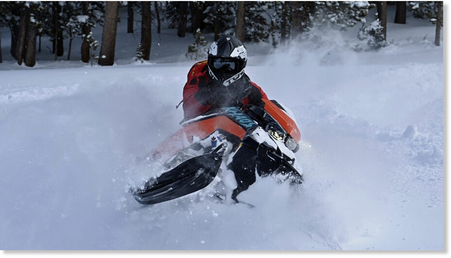
Fresh powder is a coveted commodity in the snowmobiling business, and riders in the Snowy Range are over their heads in the bounty of recent storms.

"We're hearing reports of up to 7 feet of powder up near the top of the range," Hunter Wright, director of operations at Albany Lodge, told Cowboy State Daily on Monday.

"It's gotten so deep in places, people are even getting stuck out on the flats,
" he said, adding that 4-5 feet of powder has been reported across most of the Snowy Range's extensive snowmobiling network.

Snow Sharks'

It's shaping up to be a banner year for sledding, meteorologist and snowmobile enthusiast Don Day of Cheyenne told Cowboy State Daily.

"The deep powder snowmobiling is just incredible right now in the Snowies and the Sierra Madre," he said. "Those mountain ranges have benefited from the California storms. The way those storms came in, it just channeled everything into north central Colorado and southeast Wyoming."

That's making for some phenomenal riding, he added. Day himself hasn't been into the mountains since around New Year's, but videos friends have sent him have left him eager to go again.

In the videos, those riders "look like snow sharks going through all that powder," he said.

Highway Closers Dampen Early Numbers

The Snowy Range in southcentral Wyoming is a premier snowmobile destination, Day said.

Huge open meadows near the top of the range allow people to cut loose in a relatively safe environment that has something for riders of all skill levels.

Wright said that with the word getting out on social media about just how good conditions are, he expects a wave of business at the lodge.

However, weather-related closures along Interstate 80 and other major routes have kept many out-of-state powder hounds from getting to the trails just yet.

"As soon as that (highway) opens, I think we're going to get pretty busy," Wright said.

The Albany Lodge, and the Snowy Range in general, is highly popular with snowmobilers from the Midwest, Wright said.

"We get a lot of visitors from Nebraska and Iowa, and quite a few people from Minnesota as well," he said. "We also get some folks coming up from Colorado, because they want to escape all the hustle and bustle in the mountains there."

Avalanche Danger Lurks

Things bode well for snowmobiling and skiing across the state, Day said.

"They've gotten more than 5 feet of fresh powder at Jackson Hole," he said.

However, much of the powder has fallen on crusty snow from earlier storms that partially melted and then refroze. That can make for extreme avalanche danger, particularly on steep slopes, he said.

"People need to be aware of that and be cautious," Day said.

And the heaviest snowfall still hasn't hit, he said.

"The really big water content storms are yet to come in March and April," he said. "This year is really trending toward the mountain snow season of 2010-2011. The Little Snake River and North Platte River drainages are well above average."
 
Back
Top Bottom