Randall was on Rogan again and briefly summarized the case for Atlantis. Well over 2 Million views already. So what I think to be a pretty reasonable good case for the Atlantis reality is getting serious traction now. I‘m sure some authorities on history won’t like that at all:
You are using an out of date browser. It may not display this or other websites correctly.
You should upgrade or use an alternative browser.
You should upgrade or use an alternative browser.
Atlantis
- Thread starter shijing
- Start date
I was going through the old sessions while working on translations and this one on November 19th where the crystals are mentioned, caught my attention:
Well, I thought that was really big, but at the same time out of curiosity and because I'm still struggling with imaging sizes in feet and inches, I wanted to compare those numbers (In meters) to the current tallest buildings in the world. And wow that's 1524 meters... I had no idea of the dimensions, here is a graphic I made taking into consideration an approximation of the proportions:

That's huge, to say the least. It is even bigger than the future skyscraper that Saudi Arabia is planning to build, being the tallest in the world. Then the localization they mentioned approx 380 miles from Laura's location, I know by then previous sessions were near Tampa area, so an approx according to Google Earth:
.png")
And then following with the same session:
I think this is the pyramid reported:
Which would be part of the Bermuda triangle area. Fascinating stuff.
Q: (L) What were the physical dimensions of these crystals and were they cut or naturally grown?
A: Varied. Were synthetic.
Q: (L) Were they faceted?
A: Yes.
Q: (L) In their faceting, what was the general configuration?
A: Pyramid.
Q: (L) Was that an absolute pyramid with the same proportions as say, the Great Pyramid at Gizeh?
A: Close.
Q: (L) How large was the largest from base to apex?
A: 5000 feet.
Q: (L) What was the average size?
A: 500 feet.
Q: (L) And was the one that was 5,000 feet tall, is that one still in existence?
A: Yes.
Q: (L) Where is that one located?
A: 380 miles due East of you?
Well, I thought that was really big, but at the same time out of curiosity and because I'm still struggling with imaging sizes in feet and inches, I wanted to compare those numbers (In meters) to the current tallest buildings in the world. And wow that's 1524 meters... I had no idea of the dimensions, here is a graphic I made taking into consideration an approximation of the proportions:
That's huge, to say the least. It is even bigger than the future skyscraper that Saudi Arabia is planning to build, being the tallest in the world. Then the localization they mentioned approx 380 miles from Laura's location, I know by then previous sessions were near Tampa area, so an approx according to Google Earth:
And then following with the same session:
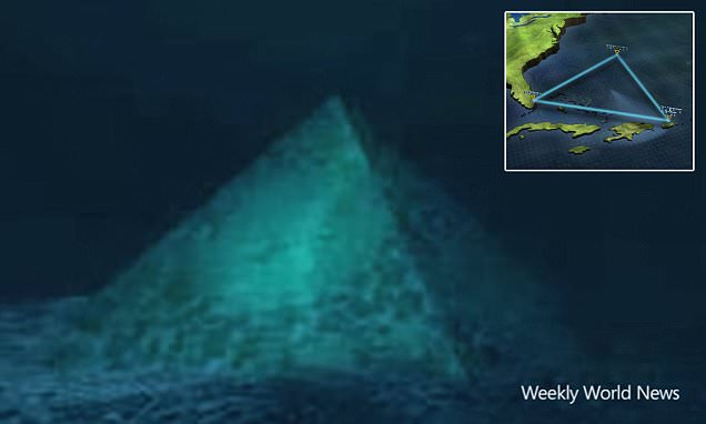
Q: (L) Some years ago a pilot reported seeing a pyramid near there in the water…
A: That is just the top sticking out of the ocean floor. It is 90 per cent buried.
I think this is the pyramid reported:
Which would be part of the Bermuda triangle area. Fascinating stuff.
I was going through the old sessions while working on translations and this one on November 19th where the crystals are mentioned, caught my attention:
Well, I thought that was really big, but at the same time out of curiosity and because I'm still struggling with imaging sizes in feet and inches, I wanted to compare those numbers (In meters) to the current tallest buildings in the world. And wow that's 1524 meters... I had no idea of the dimensions, here is a graphic I made taking into consideration an approximation of the proportions:
View attachment 58228
That's huge, to say the least. It is even bigger than the future skyscraper that Saudi Arabia is planning to build, being the tallest in the world. Then the localization they mentioned approx 380 miles from Laura's location, I know by then previous sessions were near Tampa area, so an approx according to Google Earth:
View attachment 58225
And then following with the same session:
I think this is the pyramid reported:
Which would be part of the Bermuda triangle area. Fascinating stuff.
I think the mentioned „crystal pyramid“ in the video was discussed previously somewhere on the forum. I have yet to see any proof of any of those claims made in the video and on numerous places on the internet. What annoys me to no end are claims such as „American and French research teams found a pyramid there“ and „this structure has now been independently verified by both countries research teams“ that are presented as facts while not providing any source or proof of those claims whatsoever. In fact, the video is littered with such types of claims right from the get-go until the end that are presented as „facts“ while not providing any source or proof for any of it.
It could be that much if not all of it is just made up:
Is there a crystal pyramid below the Bermuda Triangle?
Reports have re-emerged that suggest a crystal pyramid lies 2,000 metres below the surface of the Bermuda Triangle, which is roughly bounded by Miami, Bermuda, and Puerto Rico.
www.dailymail.co.uk
It could be that much if not all of it is just made up:
Maybe but even so that’s a subject that the scientific community would like to make it go away in my opinion. In that article you shared they even call the researchers “conspiracy theorist”.
They don’t take stuff like that seriously and any research that can bring some good data it’s basically not going to be taken into consideration. We may ask why there aren’t more missions to investigate the area and do much more research in the ocean floor since then? The same for the one that was reported near the coast of Azores island which according a research team there is a huge pyramidal structure as well in the ocean, and I know is not that easy to navigate deep in the ocean. But technology has improved a lot since those missions.
So unless a huge earthquake occurs, or big underwater volcanic activity or something that would elevate the sea floor for whatever reason and bring to the light these structures, we may never know more about it in real terms.
I mean it’s incredible that nowadays Egypt pyramids are still considered tombs by the official establishment after all the data contradicting that completely.
Leona
Padawan Learner
Was reading the same few days ago and wondered about the size of the pyramid... so yeah, thank you for your work and post!I was going through the old sessions while working on translations and this one on November 19th where the crystals are mentioned, caught my attention:
Well, I thought that was really big, but at the same time out of curiosity and because I'm still struggling with imaging sizes in feet and inches, I wanted to compare those numbers (In meters) to the current tallest buildings in the world. And wow that's 1524 meters... I had no idea of the dimensions, here is a graphic I made taking into consideration an approximation of the proportions:
View attachment 58228
That's huge, to say the least. It is even bigger than the future skyscraper that Saudi Arabia is planning to build, being the tallest in the world. Then the localization they mentioned approx 380 miles from Laura's location, I know by then previous sessions were near Tampa area, so an approx according to Google Earth:
View attachment 58225
And then following with the same session:
I think this is the pyramid reported:
Which would be part of the Bermuda triangle area. Fascinating stuff.
Maybe but even so that’s a subject that the scientific community would like to make it go away in my opinion.
Agreed. If such a structure exists there (which I personally find likely consider the C‘s track record) there is every reason to believe that there are powers that would want to hide it.
All I‘m saying is that anything I saw, read or heard about it so far, including the video above, doesn’t provide any shred of evidence for it and often presents embarrassingly false and outrageous „facts“ as true. Therefore, anything said in such videos and articles is suspicious and warrants viewing it with a very critical eye. An eye that assumes that much if not all of what is presented in that medium might very likely be BS and work from that standpoint instead of working from the „that is or might be true“ standpoint/foundation.
Therefore, trying to use mediums like this to build a potential case for the reality of such a pyramid, doesn’t help much or might even make things worse.
Last edited:
Something potentially interesting might be found in tracking down when and where the actual source (the first fake story) of all those claims appeared and try to find if there might have been a real report or story published anywhere (including in small local newspapers) around that time frame (earlier or on the same day as the original fake story) that could have triggered some forces to publish that fake story in order to bury or delegitimize that original story.
I think there is a good chance that something like that might have happened. But to search and look for that potential real original story is probably a difficult and daunting task. You would need to work your way through it like a detective.
You can see that process often: something true and legitimate is said or published somewhere shortly after the event in question happened (multiple shooters in a case that is later officially deemed a „lone shooter“ case, for example) and then quickly that story gets buried by fake stories or stories that are designed to delegitimize the original real story.
In the case of the pyramid, something like that might have happened: A real discovery/story was published and quickly buried or delegitimized by cover stories.
Last edited:
Saw this map of the "Pangean mountain range" on twitter. It's supposedly dated to a hundred million years ago or so. The person commented that the Appalachians were once part of a longer mountain range that connected to Ireland and Scotland and beyond. That made me think about the recent era connections between those places, particularly in terms of music and dance, due to migrants from Ireland and Scotland ending up in the Appalachians.

So I looked up "Pangea" and saw this series of maps showing the supposed development of the landmasses of earth over a long period of time.

The next, and final, thought (so far) was to wonder if the breakup or 'drifting' of the continents that supposedly happened over hundreds of millions of years actually happened much more quickly and much more recently. Basically, I wonder if the look of the global landmass in the Jurassic or Cretaceous, for example, is actually how it looked before the cataclysm that caused the younger dryas and ended last ice age. Good question for the next session perhaps. Not sure if this has already been discussed elsewhere already.
So I looked up "Pangea" and saw this series of maps showing the supposed development of the landmasses of earth over a long period of time.
The next, and final, thought (so far) was to wonder if the breakup or 'drifting' of the continents that supposedly happened over hundreds of millions of years actually happened much more quickly and much more recently. Basically, I wonder if the look of the global landmass in the Jurassic or Cretaceous, for example, is actually how it looked before the cataclysm that caused the younger dryas and ended last ice age. Good question for the next session perhaps. Not sure if this has already been discussed elsewhere already.
Chad
The Living Force
Related to the above, website Malaga Bay theorises that Scotland's landmass has significantly shifted in recent time, and provides geological data to support his theory.
He adheres to the missing time hypothesis, as detailed by Gunnar Heinsohn, but more recently i think he's gone as far as saying there's over 1000+ years missing, so bear that in mind. He also has a post or 2 on expanding earth theory too.
The whole blog post is below, and somewhere on his site, he also provides a gif of the alleged land movement.

 malagabay.wordpress.com
He adheres to the missing time hypothesis, as detailed by Gunnar Heinsohn, but more recently i think he's gone as far as saying there's over 1000+ years missing, so bear that in mind. He also has a post or 2 on expanding earth theory too.
The whole blog post is below, and somewhere on his site, he also provides a gif of the alleged land movement.
Shaping Scotland In Two Shakes
Ancient maps are frequently held in high esteem for their artistic qualities. But many observers simply dismiss the content of these ancient maps because modern maps are very different and very acc…
malagabay.wordpress.com
Shaping Scotland In Two Shakes
Posted on February 10, 2017 by malagabay
Ancient maps are frequently held in high esteem for their artistic qualities.
But many observers simply dismiss the content of these ancient maps because modern maps are very different and very accurate.
These differences are particularly stark when [for example] reviewing an ancient map that includes Scotland.
However, ignoring these strange and unfamiliar maps can be a big mistake because ancient cartographers understood that the Earth’s geography changes over time.
For example, many generations of cartographers updated the Gazetteer in Ptolemy’s Cosmographia with the latest longitude and latitude values as they changed over time.
The second redeeming feature of the Zeno Map is that it neatly dovetails with the narrative of Atlantic Expansion that’s been well documented by cartographers since [at least] 1606.
See: Iceland Goes South
Therefore, it should really come as no surprise that the strange and quirky map of Scotland [drafted by Nicolaus Germanus in 1467] fits snugly with the modern bathymetry of the North Sea.
See: The Arabian Horizon – The Ptolemy Inheritance
The Geography, also known by its Latin names as the Geographia and the Cosmographia, is a gazetteer, an atlas, and a treatise on cartography, compiling the geographical knowledge of the 2nd-century Roman Empire.
Originally written by Claudius Ptolemy in Greek at Alexandria around AD 150, the work was a revision of a now-lost atlas by Marinus of Tyre using additional Roman and Persian gazetteers and new principles.
The Geography consists of three sections, divided among 8 books.
Book I is a treatise on cartography, describing the methods used to assemble and arrange Ptolemy’s data.
From Book II through the beginning of Book VII, a gazetteer provides longitude and latitude values for the world known to the ancient Romans (the “ecumene”).
The rest of Book VII provides details on three projections to be used for the construction of a map of the world, varying in complexity and fidelity.
Book VIII constitutes an atlas of regional maps.
Geography (Ptolemy) - Wikipedia
If the Nicolaus Germanus map of Scotland is accepted at face value then we are presented with the curious conundrum of how exactly Scotland morphed into it’s current familiar form shown on modern maps.
Doggerland was an area now beneath the southern North Sea that connected Great Britain to continental Europe…
…
In July 2012, the results of a fifteen-year study of Doggerland by the universities of St Andrews, Dundee, and Aberdeen, including artefacts survey results, were displayed at the Royal Society in London.
Richard Bates of St Andrews University said:
Doggerland - Wikipedia“We have speculated for years on the lost land’s existence from bones dredged by fishermen all over the North Sea, but it’s only since working with oil companies in the last few years that we have been able to re-create what this lost land looked like.…
We have now been able to model its flora and fauna, build up a picture of the ancient people that lived there and begin to understand some of the dramatic events that subsequently changed the land, including the sea rising and a devastating tsunami.”
The North Sea is a marginal sea of the Atlantic Ocean located between Great Britain, Scandinavia, Germany, the Netherlands, Belgium, and France.
…
For the most part, the sea lies on the European continental shelf with a mean depth of 90 metres (300 ft).
The only exception is the Norwegian trench, which extends parallel to the Norwegian shoreline from Oslo to an area north of Bergen. It is between 20 and 30 kilometres (12 and 19 mi) wide and has a maximum depth of 725 metres (2,379 ft).
The Dogger Bank, a vast moraine, or accumulation of unconsolidated glacial debris, rises to a mere 15 to 30 metres (50–100 ft) below the surface.
North Sea - Wikipedia
The Devil’s Hole is a group of deep trenches in the North Sea about 200 km (125 mi) east of Dundee, Scotland.
…
Soundings showed that the surrounding seabed is between 80 and 90 metres (260 – 300 ft) but the trenches are as deep as 230 m (750 ft).
They run in a north-south direction and are on average between 1 and 2 km (.6 – 1.25 mi) in width and 20 to 30 km (12 – 18 mi) long.
https://en.wikipedia.org/wiki/Devil’s_Hole_(North_Sea)
Solving this mystery is like piecing together a jigsaw puzzle.
After some trial and error it becomes apparent the only way this ancient form of Scotland can morph into its current shape is by splitting Scotland into two independent pieces which can move independently.
This insight reveals the disintegration of Doggerland was a two step operation and that Eastern Scotland was initially separated from the British mainland by the Doggerland outflow channel.
The first step nudged Western Scotland [along with English & Wales] Northwards.
This Northward nudge appears to have damned Doggerland’s natural Northern drainage channel [in the gap between the ancient two piece Scotland] and created a [roughly] circular depression that rapidly began to fill with water.
The expansion of the freshly damned Doggerland lake [aka the North Sea] ultimately created a Southerly overflow channel which is now known as the English Channel.
The 1467 Germanus map of Scotland captures the configuration after this first step.
The second step in the transformation is far more catastrophic.
The Western section of Scotland rotates anti-clockwise by about 90° whilst the Eastern section of Scotland performs an amazing back-flip that arcs through [about] 180°.
Although this scenario may sound preposterous there is clear supporting evidence because the boundaries of the ancient two piece Scotland align with the Great Glen Fault and the Highland Boundary Fault.
In other words: ancient Eastern Scotland was transformed into the Grampian Mountains.Aligned northeast to southwest, the Great Glen Fault extends further southwest in a straight line through Loch Linnhe and the Firth of Lorne, and then on into northwestern Ireland, directly through Lough Foyle, Donegal Bay and Clew Bay.
Great Glen Fault - Wikipedia
The Highland Boundary Fault is a major fault zone that traverses Scotland from Arran and Helensburgh on the west coast to Stonehaven in the east.
It separates two distinctly different physiographic and geological terrains: the Highlands from the Lowlands, and in most places it is recognisable as a change in topography.
Where rivers cross the fault, they often pass through gorges, and the associated waterfalls can be a barrier to salmon migration.
Highland Boundary Fault - Wikipedia
To the north and west of the Highland Boundary Fault lie hard Precambrian and Cambrian metamorphic rocks: marine deposits metamorphosed to schists, phyllites and slates, namely the Dalradian Supergroup and the Highland Border Ophiolite suite.
To the south and east are Old Red Sandstone conglomerates and sandstones: softer, sedimentary rocks of the Devonian and Carboniferous periods.
Between these areas lie the quite different rocks of the Highland Border Complex (at one time called the Highland Boundary Complex), a weakly metamorphosed sedimentary sequence of sandstones, lavas, limestones, mudstones and conglomerates.
Highland Boundary Fault - Wikipedia

The official mainstream dating for this second step in the catastrophic Shaping of Scotland places these events somewhere between the original production of Ptolemy’s Cosmographia in [about] 150 CE and the drafting of the map by Germanus in 1467 CE.
The Grampian Mountains or Grampians (Am Monadh in Gaelic) are one of the three major mountain ranges in Scotland, occupying a considerable portion of the Scottish Highlands in northeast Scotland.
The range extends southwest to northeast between the Highland Boundary Fault and the Great Glen, occupying almost half of the land-area of Scotland and including the Cairngorms and the Lochaber hills.
The range includes many of the highest mountains in the British Isles, including Ben Nevis and Ben Macdui the two highest.
Grampian Mountains - Wikipedia
The Old Japanese Cedar Tree chronology clearly highlights two catastrophic events during the 1st millennium: 637 CE [Arabian Horizon] and 914 CE [Heinsohn Horizon].
Therefore, it’s very likely that the catastrophic second step events occurred in 914 CE.
This timing conforms to the cartographic evidence that clearly documents the separation of Europe from North America as the North Atlantic expanded during the 2nd millennium.
This second step in the catastrophic Shaping of Scotland explains why the last remaining vestiges of Doggerland were swept away by a “catastrophic” tsunami which buried many mainland settlements under a thick blanket of mud.
See: Finding Frisland
Aligned northeast to southwest, the Great Glen Fault extends further southwest in a straight line through Loch Linnhe and the Firth of Lorne, and then on into northwestern Ireland, directly through Lough Foyle, Donegal Bay and Clew Bay.
…
The fault continues on the North American side of the North Atlantic Ocean, but is no longer part of a contiguous fault, as the complete fault was broken when the Mid-Atlantic Ridge formed 200 million years ago.
The North American side of the fault runs through the length of northwestern Newfoundland, Canada, as the Cabot Fault (Long Range Fault) and on into the Gulf of St. Lawrence. It is at least 300 miles (480 km) long.
Great Glen Fault - Wikipedia
No wonder, centuries later, so many curious Europeans wanted to explore this New World.Analysis suggests the tsunami over-ran Doggerland, a low-lying landmass that has since vanished beneath the waves.
…
Prof Vince Gaffney, an archaeologist at the University of Birmingham, said: “I think they (the researchers) are probably right, because the tsunami would have been a catastrophic event.”
Prehistoric North Sea ‘Atlantis’ hit by 5m tsunami
BBC News – Paul Rincon – 1 May 2014
Prehistoric North Sea 'Atlantis' hit by 5m tsunami
Reconstructions of Viking port towns of the 8th-10th c. CE supposedly not
needed from 1-700 CE when wading through treacherous surf would do.
Vikings For 700 Years Without Sails, Ports, and Towns?
Gunnar Heinsohn – June 2014
Click to access heinsohn-viking-pdf-062014.pdf
Hedeby was an important Viking Age (8th to the 11th centuries) trading settlement near the southern end of the Jutland Peninsula, now in the Schleswig-Flensburg district of Schleswig-Holstein, Germany.
Hedeby - Wikipedia
The New World is one of the names used for the Earth’s Western Hemisphere, specifically the Americas (including nearby islands such as those of the Caribbean and Bermuda).
The term originated in the early 16th century after Europeans made landfall in what would later be called the Americas in the age of discovery, expanding the geographical horizon of classical geographers, who had thought of the world as consisting of Africa, Europe, and Asia, collectively now referred to as the Old World (a.k.a. Afro-Eurasia).
New World - Wikipedia


The Western section of Scotland rotates anti-clockwise by about 90° whilst the Eastern section of Scotland performs an amazing back-flip that arcs through [about] 180°.
If that's what happened, it's mind-boggling how it occurred. I mean, it's one thing for part of a landmass to sink or rise, but to do an hinge-like rotation??

Chad
The Living Force
If that's what happened, it's mind-boggling how it occurred. I mean, it's one thing for part of a landmass to sink or rise, but to do an hinge-like rotation??
He has a few other posts that talk of swings like that (such as this), and in others it's just earth expansion theory; and in a number of those he supports his ideas comparing old maps showing how the current location has shifted by 'so many' degrees. Pretty sure he uses other data, such as wildlife, or human cultural artefacts and what not. He also takes into account cataclysmic event in his ideas.
Like i say, he claims that we're missing 1000 years of time - and about that he seems pretty certain! - whereas even Heinsohn, who he credits throughout his blog, only claims 700.
Despite some of his more out there (or extreme) theories, i've found quite a few of his ideas interesting to consider nonetheless. But i personally don't know enough about the subject matter to say either way.
M
MikaelYosef
Guest
If that's what happened, it's mind-boggling how it occurred. I mean, it's one thing for part of a landmass to sink or rise, but to do an hinge-like rotation??
I'm not a geologist, so thinking outside the box. But could it be related to fluid dynamics and involve some other kind of subterranean 'mega-structure' that creates a drag/resistance to the flow of matter above it (i.e., landmasses)? For example, a floating object in a flowing stream, or a piece of pasta in a boiling pot of water will move on the surface in a certain way. But if a fixed or relatively stationary object is put in its path, even if under the water to affect the flow above it, the objects will move differently. If there were solid and fixed objects within the molten earth, it could influence the action of the 'floating' land masses above.
Just an outside thought from a non-expert. Could be completely wrong and ridiculous.
Do you have any speculations on how this could have occurred?If that's what happened, it's mind-boggling how it occurred. I mean, it's one thing for part of a landmass to sink or rise, but to do an hinge-like rotation??
So by this perhaps North America was in the position of Atlantic Ocean along with Greenland.If that's what happened, it's mind-boggling how it occurred. I mean, it's one thing for part of a landmass to sink or rise, but to do an hinge-like rotation??
And also Antartica, could have been more into the Atlantic Ocean as well.
Trending content
-

-
Thread 'Coronavirus Pandemic: Apocalypse Now! Or exaggerated scare story?'
- wanderingthomas
Replies: 30K -
