XPan
The Living Force
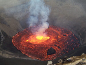
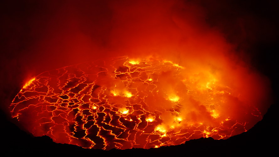
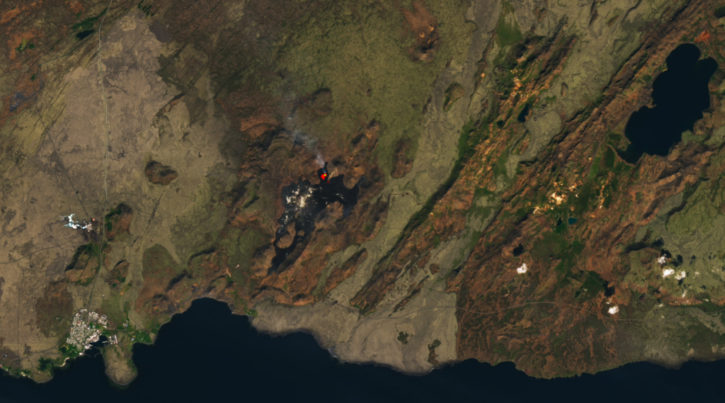
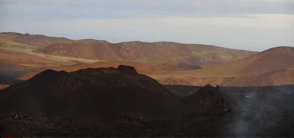
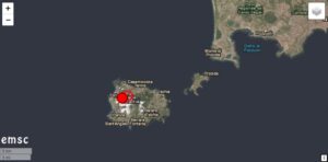
Fagradalsfjall, Iceland
It appears that the eruption, for the time being, has fallen asleep. Vulkane.net reports today following
Fagradalsfjall peacefully fallen asleep
by Marc Szeglat

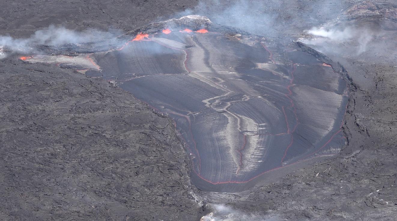
Iceland's Fagradalsfjall volcano went to sleep first thing this morning: the tremor has crashed and the degassing has greatly subsided. In the darkness of the night, red-illuminated vapour clouds could still be seen above the crater, and every now and then a glowing lump flew over the crater rim. It is uncertain whether the volcano will awaken again in the next few hours/days and I have postponed my planned trip for today. In the meantime, I've accumulated a number of open tickets, and I'm curious to know when I'm supposed to fly them all off!

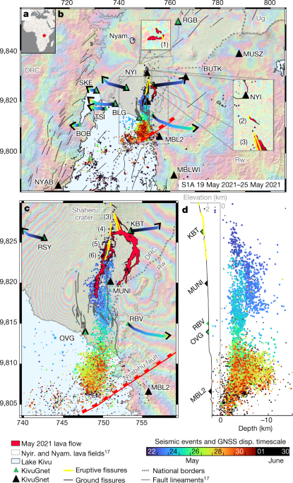
If you take a closer look at the tremor chart, you can see that it has been decreasing steadily over the last few days, only to drop sharply this morning. This steep drop was typical of the pulses last year. However, without the tremor having decreased continuously for such a long time before that. Therefore, the current behaviour does not allow a direct comparison with last year's situation and we have to wait and see how the situation develops. The fact that no more earthquakes have been detected under Reykjanes since yesterday evening speaks for an end of the eruption. It looks as if the peninsula has just relaxed deeply.
According to the latest data from geoscientists at the University of Reykjavik, a good 11 million cubic metres of lava were produced during the eruption. It can be assumed that there is still melt in the magmatic passage, but for this to erupt, further magma supply from the depths will be necessary. So I would expect an increase in seismicity before a resurgence of the eruption.
After the eruption is before the eruption, however, and many Icelandic scientists believe that a long-term period of activity has begun on Reykjanes. So it seems to be only a matter of months before we will see more eruptions there, unless the current eruption is revived.
END OF ARTICLE
It appears that the eruption, for the time being, has fallen asleep. Vulkane.net reports today following
Fagradalsfjall friedlich eingeschlafen - Vulkane Net Newsblog
Heute Morgen ist der Tremor am Fagradalsfjall stark gefallen. Es sieht so aus, als würde der Vulkan zumindest eine Pause einlegen.
www.vulkane.net
Fagradalsfjall peacefully fallen asleep
by Marc Szeglat
Iceland's Fagradalsfjall volcano went to sleep first thing this morning: the tremor has crashed and the degassing has greatly subsided. In the darkness of the night, red-illuminated vapour clouds could still be seen above the crater, and every now and then a glowing lump flew over the crater rim. It is uncertain whether the volcano will awaken again in the next few hours/days and I have postponed my planned trip for today. In the meantime, I've accumulated a number of open tickets, and I'm curious to know when I'm supposed to fly them all off!
If you take a closer look at the tremor chart, you can see that it has been decreasing steadily over the last few days, only to drop sharply this morning. This steep drop was typical of the pulses last year. However, without the tremor having decreased continuously for such a long time before that. Therefore, the current behaviour does not allow a direct comparison with last year's situation and we have to wait and see how the situation develops. The fact that no more earthquakes have been detected under Reykjanes since yesterday evening speaks for an end of the eruption. It looks as if the peninsula has just relaxed deeply.
According to the latest data from geoscientists at the University of Reykjavik, a good 11 million cubic metres of lava were produced during the eruption. It can be assumed that there is still melt in the magmatic passage, but for this to erupt, further magma supply from the depths will be necessary. So I would expect an increase in seismicity before a resurgence of the eruption.
After the eruption is before the eruption, however, and many Icelandic scientists believe that a long-term period of activity has begun on Reykjanes. So it seems to be only a matter of months before we will see more eruptions there, unless the current eruption is revived.
END OF ARTICLE


")