Volcanoes Erupting All Over

Vulcano, Aeolians Islands - Sicily, Italy
6 April 2022

I file this entry about the earthquake unrest at Vulcano under volcanoes, instead of earthquakes.
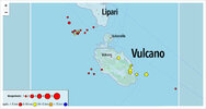
Bild_2022-04-06_132824116.jpg

🇩🇪 Vulkane.net writes:

Seismicity increased significantly on Vulcano

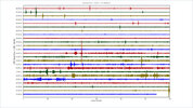
There were other earthquakes in the area of the Lipar island of Vulcano. Most of them manifested themselves in an arc near the isthmus between Vulcano and Lipari and had low magnitudes. Yesterday there were 11 quakes, which is already a considerable number for Vulcano. Since the beginning of the crisis in October last year, INGV has never had so many quakes in such a short time, although local VLP quakes (frequencies below 1 kHz) do not appear there anyway. Their number was significantly lower last week than at the beginning of the crisis. Apart from that, the last weekly report says that the gas emission is still high and has not decreased significantly.
 
São Jorge, Azores - Portugal
7 April 2022

The reporting from german Vulkane.net continues about the conditions in the Azores (again, I put my entry into the volcano section, instead of earthquakes), and as usual translated with DeepL.


São Jorge: Volcanotectonic earthquakes detected

Today, the events on the Azores island of São Jorge are again the focus of my reporting.

Summary

• Volcanic earthquakes have been detected on São Jorge
• They are a further indication of magma rise
• Previous tremors were tectonic in nature
• The behaviour of the volcano is mysterious

20220406.jpg

The seismic crisis on the Azores island of São Jorge has lost much of its momentum in the last week, but microseismicity is still being recorded, with the occasional stronger earthquake mixed in.

Since the earthquakes began on 19 March, a good 28,000 tremors have now been detected. More than 200 quakes were so strong that they could be felt by local residents. Until Tuesday, all quakes were of tectonic origin, but now hybrid earthquakes have been recorded for the first time. These are a mixture of volcanotectonic tremors and low-frequency earthquakes, both of which are due to fluid movements in the subsurface. This should make it clear that magma is moving underground and is likely responsible for at least part of the ground uplift. Nevertheless, the situation remains a little mysterious, as one should actually expect a stronger presence of volcanotectonic earthquakes if ground uplift due to magma rise is already occurring.

Processes under São Jorge partly mysterious

The presence of magmatic fluids in the subsurface does not mean that a volcanic eruption is imminent. In fact, it is not yet possible to predict if and when an eruption will occur on São Jorge. Most recently, Canarian scientists concluded that a good 20 million cubic metres of lava had accumulated under the island. Since then, the ground elevation has continued to increase.

Methinks that the signs of volcanic eruptions in the Azores have not been sufficiently researched. There have simply been too few eruptions in recent decades. Every volcanic system is unique and knowledge gained from other volcanoes is not necessarily transferable 1:1 to every volcano. The current seismic crisis in the Azores presents a good opportunity to learn more about the volcanoes there.

There are 26 known volcanic systems in the Azores. The last major eruption manifested itself in 1958, when Capelo erupted on Faial. In 1964, there was probably a smaller submarine eruption off São Jorge. So geoscientists have a lot of work to do before they will be able to properly understand the volcanoes of the islands and correctly interpret processes in the Earth's interior.
 
Mud volcano erupts near temple in Pingtung's Wandan Township
04/08/2022 04:14 PM

Listen
Photo courtesy of Chen Yu-i

Photo courtesy of Chen Yu-i
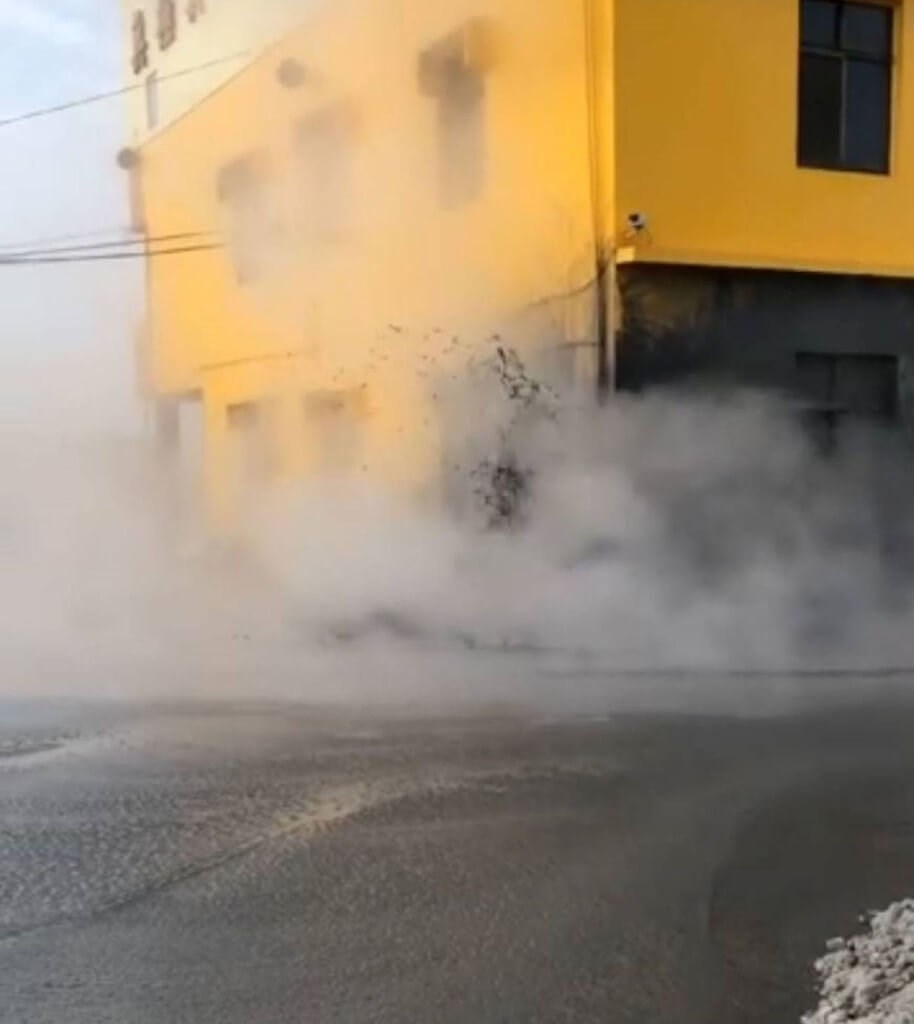
Taipei, April 8 (CNA) A mud volcano erupted near a local temple in Wandan Township in Pingtung County on Friday morning, heaving large amounts of mud above ground that flowed into surrounding roads and fields.
The eruption, the second by the volcano since October 2021,
occurred at around 6 a.m. near Huang Yuan Sheng Tien (皇源聖殿), a temple surrounded by farmland in Wannei Village in the eastern part of the county near Kaohsiung.
The bursts reached as high as a one-story building, and to keep the mud from further spreading into nearby rice paddies, excavators were mobilized to channel mud toward drainage ditches, Wannei Village chief Chen Yu-i (陳玉意) told CNA.
Normally a fire would be lit to accelerate the release of natural gas, but because this eruption occurred close to the temple, the village decided to let the gas release on its own without igniting a fire, Chen said.
The Wandan mud volcano usually erupts one to three times a year, with the eruptions mostly occurring in Wannei or other nearby villages.
About 90 minutes after the mud volcano erupted, a magnitude 5.6 earthquake shook
the county, and some wondered if the two natural phenomenons were connected.
Central Weather Bureau Seismological Center Director Chen Kuo-chang (陳國昌) said the two events were unrelated because they occurred far from each other and were triggered by different reasons.
Chen said the earthquake was centered in waters 30 kilometers off the coast of Eluanbi, Taiwan's southernmost point, at a point more than 100 kilometers from Wannei, and occurred because of the subsidence and compression of tectonic plates near the Pingtung submarine ridge.
 
Campi Flegrei (Phlegraen Fields), Pozzuoli - Napoli, Italy
8 April 2022


Campi Flegrei: The sea also changes colour

8 April 2022 • by Marc Szeglat (article in german language) I used DeepL for the translation

Today the Italian caldera volcano Campi Flegrei (Phlegraean Fields) is again in the focus of my reporting. The reason is more earthquakes and discoloured sea water.

Summary:


- The water off the coast of Pozzuoli became discoloured
- The reason for this is probably an algae bloom
- Seismicity is still elevated
- There was also further microseismicity at Vulcano


Bild_2022-04-08_104733211.jpg

From the Campi Flegrei and the Gulf of Pozzuoli there is more disturbing news:

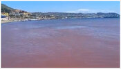
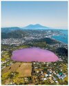
After the water in the crater lake d'Averno turned reddish, video footage has now been posted documenting a discolouration of the seawater on the coast. The red colouration of Lago d'Averno is caused by an algae bloom. This usually happens in winter when there is a rearrangement of the water: it becomes warmer at depth than at the surface and the algae rise and start to multiply. The excitement among the residents of the region is accordingly great.

Many people are asking themselves whether there is not a connection with volcanism and bradyseism. In the social media, people are asking whether the seabed might have heated up to such an extent that it caused the algae bloom. It is still not possible to answer this question. The poster of the video wrote in a comment that he had never seen an algal bloom in the sea before. Algal blooms are already known in the Mediterranean, but mostly in summer when the water temperatures are unusually high.

Therefore, in my opinion, the concerns of local residents are not entirely unfounded. So far, there is no scientific proof of a connection between algal blooms and a possible volcanically induced heating of the sea floor. Nevertheless, it is conceivable that increased fumarolic activity not only warms the seawater, but also introduces nutrients that favour an algal bloom.


Pozzuoli, Lucrino beach, the sea turns red; they say that it is the algae of Lake Ano that is rotting, but I have never seen such a phenomenon, never so pronounced, could it be that the bottom of the lake is overheating because of bradyseism? At least say it... - in Pozzuoli.


Bild_2022-04-08_102339902.jpg


Further earthquakes in the Campi Flegrei

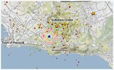
On the other hand, it is scientifically proven that the seismicity of the Campi Flegrei is increased. Since yesterday, 16 new quakes have been recorded. The strongest had a magnitude of 1.9 and a hypocentre at a depth of 1.9 km, which means it was in the area of the hydrothermal system. The epicentre was located a few metres south of the Solfatara crater. There were further quakes with magnitudes above 1. They all manifested themselves in the fringe area of Solfatara.

Vulcano with further tremors

In this context, it should be mentioned that not only the Campi Flegrei is unsettled, but also the Liparic island of Vulcano. Both regions are not too far from each other and are connected by tectonic processes. Here, there have been further microquakes in the region of the strait to Lipari. So far it is unclear whether they are of volcanic origin or tectonic. In any case, I am very much looking forward to the next INGV weekly report, which we can expect on Tuesday.
 
Vulcano, Aeolian Islands - Sicily / Italy
10-13 April 2022

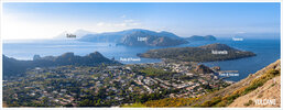
2018-05-25-18-31-52pano_1.jpg
Image from 25 May 2018, standing afoot of the Vulcano rim. In the bay of Porto di Ponente our hotel was located.


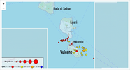
vulcano.png
latest earthquake map with the same angle, 10 April 2022


Vulcano with more earthquakes in April
13. April 2022 by Marc Szeglat

Date: 10.April.22 | Time: 07:23 UTC | Location: 38.3949; 15.0175 | Depth: 10.2 km | Mb 1.9

• More earthquakes detected under Vulcano
• In April there were already 53 tremors
• Sulphur dioxide emissions have risen slightly


"More tremors have occurred under the Lipari island of Vulcano. Since 9 April, 9 earthquakes have been added, so that 26 earthquakes are already shown on the earthquake map this month. However, the quakes on the display are filtered, because a total of 53 tremors already occurred in the area of Vulcano in April. In the whole of March there were 44, so we are experiencing an increase in seismic activity.

The strongest of the new earthquakes had a magnitude of 1.9 and a hypocentre at a depth of 10.2 km. The epicentre was 6.0 km east of Porto di Ponente.

In my last update I wrote that I am looking forward to the new weekly bulletin of the INGV. There, the increase in seismic activity receives little attention at first. The summary says: " Local seismicity: Low frequency of local events. Regional seismicity: Moderate fracture seismicity in connection with earthquakes with Ml from 1.0." The more detailed analysis then states that local seismicity in the frequency band below 1 Hz (VLP events) did not increase compared to the previous week. However, the regional earthquakes with magnitudes greater than 1 are described in more detail.


Sulphur dioxide emissions on Vulcano increased

It is also interesting to note that sulphur dioxide emissions from the fumaroles at the crater rim have increased again. The values are described as medium high, with an upward trend. Carbon dioxide emissions remain high. No new ground deformation has been detected. Nevertheless, it is possible that there is a connection between the earthquakes and the increasing gas emission, even if the earthquakes were not directly triggered by fluid movements. Gas rising from the magma body could have increased the pressure on the fault zones. It should also be noted that quite a few earthquakes occurred offshore in a cluster. Here, a possible ground uplift would be difficult to detect.

While we have seen a slight easing of the situation on Vulcano in the last few weeks, there is now again a slight increase in the geophysical parameters related to the intruded magma body. An imminent volcanic eruption cannot necessarily be read from the data, but phreatic explosions could occur at any time. Before a stronger magmatic eruption, one would expect a seismic crisis with further magma rise. However, spontaneous eruptions cannot be ruled out. The alarm status is set to "yellow".
 
The Centro Nacional de Prevención de Desastres (CENAPRED) observatory detected an elevated of volcanic tremor over the past three days. A daily volcanic tremor duration increased from medium-low values to approx. 800 min on average since 11 April. The seismic network detected 687 minutes(11 Apr), 953 minutes (12 Apr) and 793 minutes (13 Apr) of continuous ground vibration. Volcanic tremor is related to magma migration within the surface.
Continuous emissions of steam, gas and a light amount of ash occurred throughout the night from the summit extending NE.
The explosive activity is dominated by near-constant eruptions generating 1 km tall ash plumes.
The alert level for the volcano remains at "yellow".
Source: Centro Nacional de Prevención de Desastres volcano activity update 14 April 2022
 
Stromboli, Aeolian Islands - Sicily | Italy
11 April 2022


Two Israeli hikers rescued from active italian volcano.

Well yes, Stromboli is permanently active - but the rescue has in my opinion nothing to do with Stromboli being active - because the scene of the accident happened in a rift/ravine valley, called Vallonazzo (independent from Stromboli being active or not, I mean)

This "mini" valley is fascinating, and so is the entire island of Stromboli, because you face a strange contrasts between "large" and "small" and "mighty". At times you wouldn't think that a small island can have so many different features... Once you get to the mini valley of Vallonazzo, you realize that it is actually much bigger than any map or satellite chart can tell you. Being there, gives you a real impression - and yes, you can really get seriously hurt or even die, if you stumble into the ravine by going off the paths.

When I watch the video clip, it looks as if the accident happened in the upper part of the Vallonazzo Rift.

Times of Israel wrote:

Father falls down into Stromboli cauldron, injuring his chest and shoulder; unharmed son manages to call for help.

Two Israelis were rescued while hiking the volcano of Stromboli in southern Italy, local media and Italian authorities reported on Monday. The two, a father and son, were hiking in a canyon in the Vallonazzo area when the father fell nearly 50 meters (164 feet) down the volcano cauldron, suffering injuries to his shoulder and chest, while the son was unharmed, according to Italian media. Local media said the son managed to climb up and get help and a helicopter team was sent to the location. Italy’s firefighting force published a video of one of the hikers being lifted onto the helicopter via winch. The two were reunited with their family shortly afterward at a local medical center.

Stromboli, located on an eponymous island north of Sicily, is a popular hiking spot in southern Italy, despite remaining an active volcano in continuous eruption.

On August 28, 2019, an explosive eruption sent a pyroclastic flow down the volcano’s northern flank and into the sea, where it continued for several hundred meters before collapsing. The resulting ash column reached a height of 2,000 meters (6,600 feet).


Vallonazzo Ravine, Stromboli 1930

On 11 Sep 1930 a major eruption took place at the Stromboli volcano (one of the largest known at Stromboli), sending a glowing avalanche down the Vallonazzo valley, all the way to the sea and further - killing 6 fishermen who were in the path of that cloud.

iu.jpg


Photo Collection, 2006
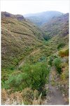
I have collected a few photos to show you how the Vallonazzo valley looks like, from a visit back in 2006 - but they are from the middle part of the valley. If you do not go astray (e.g. not going off the path), you will likely not fall down anywhere.

2006-07-27-20-09-04.jpg
Gianni looking over the Vallonazzo Ravine (panorama), Stromboli 2006

2006-07-27-20-12-50.jpg
The Vallonazzo Ravine in reality, is much larger than you would expect.

2006-07-27-20-16-18.jpg


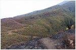
This is the view when standing at middle height at the Vallonazzo Valley, looking up all the way to the top of Stromboli (whose crater are behind the mountain crest, at lower elevation). The accident of the Israeli's likely happened in the upper part of the Vallonazzo valley.

2006-07-27-20-19-59.jpg

After having walked down the path and up on the other (this) side looking back. The burned vegetation was caused by a major fire (which was not caused by volcanic activity)
 
Anak Krakatoa, Indonesia
17 April 2022

The text comes from in German written Vulkane.net


"Anak Krakatoa changed eruption behaviour"
17. April 2022 by Marc Szeglat

Country: Indonesia | Coordinates: -6.10, 105.42 | Eruption: Ejective

278480776_2126044260905854_7543796473987827926_n.jpg

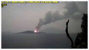
Tonight, Anak Krakatau is turning up a notch further and erupting continuously.

Not only ash is produced, but also incandescent tephra. While the ash rises up to 2100 m, the incandescent tephra makes it a good 120 m high. Looking at the LiveCam image, it looks like incandescent lava is accumulating at the crater. Possibly a lava flow is moving. This would be indicated by the high thermal radiation detected by MIROVA. It has an output of 143 MW. Lava flows are not uncommon at Krakatoa, even though the volcano mainly produces explosive eruptions.

Lava flows at Krakatau are viscous

When Anak Krakatau erupts effusively, it usually produces a moderately viscous aa lava. The lava flows become several hundred metres long and often reach the coast, where they run into the sea. This can lead to strong steam emissions and rarely to littoral explosions. Ocean entry at Krakatau is not as aesthetically pleasing as at Kilauea in Hawaii, where thin pahoehoe lava often runs into the sea. The effect is the same on both volcanic islands: lava tongues (deltas) are formed that can protrude far into the sea.

Typically, the lava deltas can collapse and are eroded again comparatively quickly. Most recently, we experienced an ocean entry on La Palma. One is brewing at Wolf Volcano, in the Galapagos Islands.

After the collapse of the volcano Anak Krakatau, which happened in December 2018, the island already grew a good bit again. Immediately after the disaster, the crater was directly on the coast and open to the sea. Most recently, there was no longer any direct connection with the ocean, but it cannot be ruled out that seawater could come into contact with the melt in the conveyor system/crater, which could result in phreatomagmatic eruption.
 
Anak Krakatoa, Indonesia
23 April 2022

The little island volcano in the Sunda Strait between Java and Sumatra in Indonesia, makes more headlines as of lately - showing continuous activity, and ash up an altitude of roughly 6000 meter.

🇩🇪 Vulkane.net by Marc Zeglat wrote following, translated with DeepL


Anak Krakatoa with Ocean Entry
23. April 2022 by Marc Szeglat

Country: Indonesia | Coordinates: -6.10, 105.42 | Eruption: Ejective, effusive

- Krakatau ejects ash up to 6100 m altitude
- A lava flow reaches the sea
- Seismicity is relatively low


Ash and lava at Krakatau

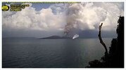
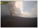
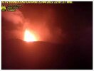
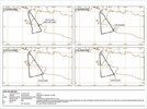
Activity continued to increase at the Indonesian volcano Anak Krakatau. VAAC reports an ash cloud at 6100 m altitude. It is drifting towards the southeast. At night, intense red glow was seen at the main crater. So incandescent tephra was erupted. On the LiveCam you can see not only a quite impressive ash cloud, but also a small steam cloud rising from the coast. Apparently, a lava flow is flowing into the sea there. Alternatively, a vent could have formed there. Last week I already speculated that a lava flow could be being produced that would eventually lead to an ocean entry.

Occasionally, fishing boats can be seen bobbing in the archipelago. Beyond that, there don't seem to be any regular visits to the small archipelago, at least eye-witness reports are pending. Tourist visas have been issued again in Indonesia for two weeks, but tourism has not yet resumed and thus there are no volcano spotters to keep us informed.

kraent.jpg kraent01.jpg

kraent02.jpg IDY65305.jpg


Seismicity on Anak Krakatoa comparatively low

Yesterday, the VSI/PVMGB instruments registered only 1 seismic eruption signal and 25 strong degassings. Today, however, there were already 8 eruptions and the same number of degassings. In fact, the ash emission is constant over longer periods of time, so the seismic signals must be quite long. The seismicity is slightly increased. Yesterday, 6 tremors and 8 volcano-related earthquakes were recorded. The seismicity does not represent the magma rise one would expect from an increasing eruption.

This fact suggests that the ascent pathways are unobstructed and that the magma can rise virtually unimpeded without generating much noise in the subsurface. However, there was a seismic crisis in mid-March, during which up to 340 volcano-related earthquakes per day were recorded. The phase of high seismicity lasted 5 days. At that time, melt probably collected in a shallow reservoir from which it is now rising.
 
Anak Krakatoa, Indonesia
24 April 2022

One day later - there is more going on with the Krakatoa volcano... 🇩🇪 Vulkane.net wrote this:


Anak Krakatau erupts continuously
24. April 2022 by Marc Szeglat (translated with DeepL)

- Anak Krakatau increased its activity further

- The tremor is very high and resembles a paroxysm
- A lava fountain was produced

kra.jpg

In Indonesia's Sunda Strait


between Java and Sumatra, Anak Krakatau continues to be active. VAAC detects volcanic ash at 6000 m altitude. On the livecams, a high rising ash cloud is visible through the haze. There is no wind and the cloud rises vertically.

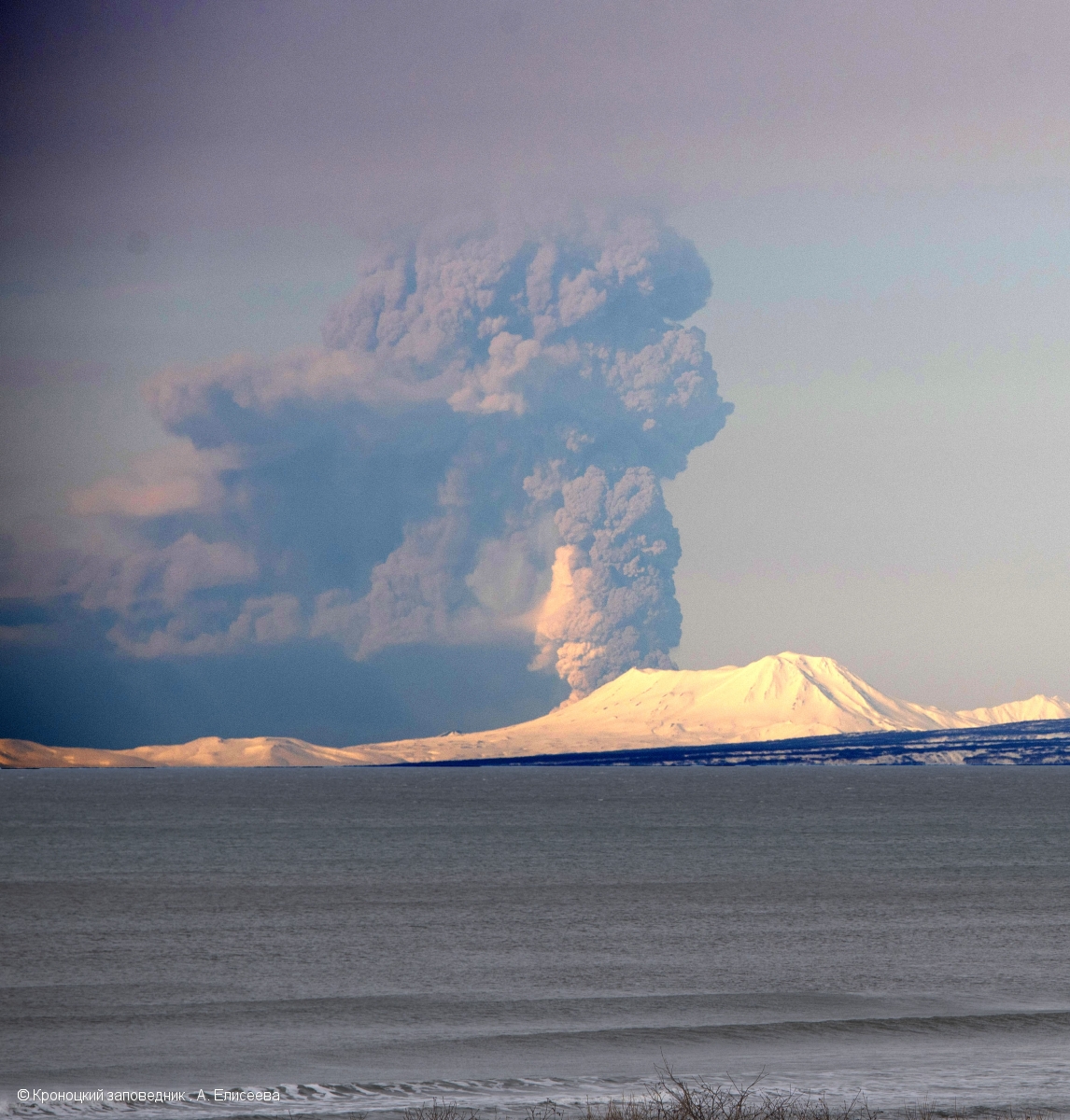
Intense red glow had been visible at night. It came from red-hot tephra that was continuously spewed out in a lava fountain. The coastal area of the island was also covered with tephra. Lava flows reached the coast and flowed into the sea. A livestream was broadcast at night, including the tremor curve. It showed a steep rise last night, reminiscent of a paroxysm. A plateau formed, at the level of which the tremor continues to move sideways. The MAGMA/VSI status report only mentions tremors whose seismic signal was registered. There is no mention of eruption signals or volcano-related earthquakes. Probably the tremor is so strong that it overlaps other signals. A similarly high tremor was last seen in 2018, when there were several paroxysms, resulting in the landslide.

New photo of eruption cloud at Krakatau

A picture has just been posted on Twitter that shows the eruption cloud more clearly: it contains a lot of water vapour. It is quite possible that phreatomagmatic eruptions are occurring and water has entered the conveyor system. It is unlikely that such a large steam cloud would be caused by an ocean entry. In that case, a large lava flow would have to enter the sea. Unfortunately, yesterday's ocean entry is not mentioned in the VSI reports.


A comparatively large steam cloud

can already be seen on satellite images from 19 April, as well as a thermal signal in the crater. However, 5 days ago the activity was much less than now. New images will show the changes, then it will be possible to estimate whether and how much lava has flowed into the sea. Unfortunately, the last photo only showed white out.
 
Back
Top Bottom