The Ice Age Cometh! Forget Global Warming!

This is an interesting video talking about ice ages forming through Milankovitch Cycles. Its not bad generally showing how many complex factors are involved forming cycles. Yes, he does mention the humans my cause climate change trope, but I think its very educational overall.

Add to it the electric universe theory and the cosmic winter theory and we have a mind-boggling complex dynamic at play.


Attachments

  • Screenshot 2022-12-25 at 16-36-32 M1SSING (@M1SSINGPERSONS) _ Twitter.png
    Screenshot 2022-12-25 at 16-36-32 M1SSING (@M1SSINGPERSONS) _ Twitter.png
    475.6 KB · Views: 16
  • Screenshot 2022-12-26 at 07-11-08 Tomer Burg (@burgwx) _ Twitter.png
    Screenshot 2022-12-26 at 07-11-08 Tomer Burg (@burgwx) _ Twitter.png
    459.6 KB · Views: 14
  • Screenshot 2022-12-24 at 19-16-16 kafisss on Twitter.png
    Screenshot 2022-12-24 at 19-16-16 kafisss on Twitter.png
    319.9 KB · Views: 16
  • Fj_vUYIUcAA-bxy.jpg
    Fj_vUYIUcAA-bxy.jpg
    420.8 KB · Views: 17
Last edited:

“People who don’t understand the destabilising effect of global warming on the polar vortex are convinced unusually cold temperatures prove it’s all a #climatescam. “


“In 1975, @ScienceNews used the same diagram to explain global cooling. According to members of the #ClimateScam cult, global warming and global cooling have identical symptoms.”

 
Good one humans!!

"This extreme cold weather across many parts of the USA & Canada has been extremely harsh for people & wildlife. This crazy footage shows two walkers who spotted a deer with its mouth,eyes & ears completely frozen over. Brilliant effort to help!
👏🏼
Stay safe everyone"
 
From Croatian Met portal on US/Canada freeze:

Many people do not perceive correctly how deep this extreme cold actually penetrates in the south. Imagine a situation where we measure -30 °C in Split, it snows at -8 °C on the African coast, and the extreme cold reaches all the way to the south of Egypt! This is exactly what is happening in the USA.

The cold front will even reach the latitudes of Qatar. It is currently -2 °C in Brownsville, and the city is located on the coast of the Gulf of Mexico at the latitude of Doha! Cities located on the latitude of Croatia - better not to think about it, there is a real ice age.

1672335986991.jpeg


Storm wallops Tahoe region with over 4 feet of snow in spots

The Palisades ski area by
The Palisades ski area by Lake Tahoe in California says it has set a new record for the most snowfall it has received in a 12 hour period, peaking at 7 inches per hour.

The atmospheric river that just slammed the Bay Area and the Lake Tahoe region left some massive snowfall numbers in its wake. And with another major storm on the way, the region could be closing in on last winter's snowfall total by the end of this week.

Tahoe Weather reports that some areas got up to 4 feet of snow in the storm with one resort, Heavenly Valley, getting 53 inches over the New Year's weekend. Kirkwood Meadows was not far behind with 47 inches.

"January is starting out with nearly 50% of the average for the entire monthly already" Tahoe Weather tweeted.


The storm also left the region well over 50% of average for the entire snow season. Dodge Ridge, which got only 22 inches in the storm, now has a season total of 210 inches, which is 70% of its average for an entire season.


The resort with the highest snow total so far is Boreal Ridge with 240 inches total, so those who enjoy night skiing shouldn't have to worry about hitting any rocks for the foreseeable future.

Palisades at Tahoe, which has just unveiled its brand new gondola, got 40 inches of snow and is at 232 inches so far.

Here are the reported snowfall totals for all the major Sierra resorts:

Sugar Bowl: 39 inches
Boreal Ridge: 43 inches
Palisades Tahoe: 40 inches
Homewood: 45 inches
Tahoe Donner: 39 inches
Northstar: 43 inches
Mt. Rose: 40 inches
Diamond Peak: 40 inches
Heavenly 53 inches
Sierra At Tahoe: 44 inches
Kirkwood: 47 inches
Bear Valley: 21 inches
Dodge Ridge: 22 inches
Mammoth: 43 inches
China Peak: 18 inches

While the numbers are impressive, it is important to remember that last winter also began with major early-season storms only to see no snow for much of January and February.

The Sierra Avalanche Center reports that avalanche danger is moderate in the Tahoe region.

 
'This week’s expected storm system should be colder and produce more snowpack. Significant flooding from local rivers and creeks throughout the state should continue for the next several days, along with strong winds, officials said.'
 

Mammoth Mountain ski resort in California closed due to too much snow - 13 FEET in just 9 DAYS since start of year​


DEEP!
© Patrick Griley/Mammoth Lakes Tourism
DEEP!


Thanks to continued snowfall, Mammoth Mountain, CA, has reported 40 - 54 inches from this current storm with an expected snow accumulation of 22 -28 inches today.

Mammoth Mountain has surpassed last year's season snowfall total and, with 419″ of fresh snow at the summit, is now officially the snowiest ski area on Earth. 310 inches have dropped at the Main Lodge, including 13 feet since January 1. The resort also has the deepest base in the country.

Mammoth has been closed today due to the intense snowfall conditions and very dangerous travel in the area. Roads have been heavily impacted and are not plowed. The resort will focus on avalanche mitigation work today and protecting our equipment. They plan to reopen tomorrow, January 11.

mmmmmmmmm
© Patrick Griley/Mammoth Lakes Tourism
mmmmmmmm
© Patrick Griley/Mammoth Lakes Tourism
mmmmmmmmm
© Patrick Griley/Mammoth Lakes Tourism
mmmmmmm
© Patrick Griley/Mammoth Lakes Tourism
 
The Article includes numerous pictures of the losing narrative of global warming.

Meanwhile, the temps here dipped to a sudden -8.889°C within just 30 hrs from Friday
PS, no snow in the ground here just copious amounts of nonstop rain.

Heavy snowfall in progress on La Mongie +35cm

Video 👀
TRAVEL chaos is set to hit today as snow blankets parts of Britain during a freezing -10 Arctic blast.

And it's only the beginning - with more warnings already placed over parts of the UK for this week.
Screenshot 2023-01-16 at 17-31-43 Travel chaos as snow hits in freezing -10C blast - with more...pngScreenshot 2023-01-16 at 17-32-30 Travel chaos as snow hits in freezing -10C blast - with more...png
Snow started falling across the country overnight, with Brits waking to their cars and roads already covered.

Photos snapped in Kent and Essex this morning showed the white stuff blanketing streets.

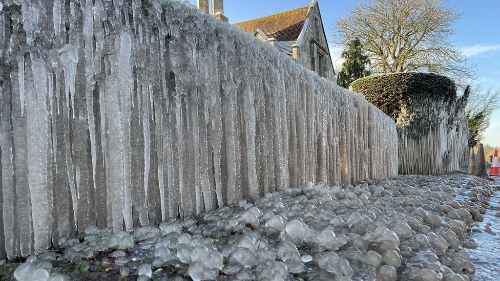
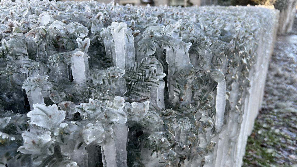
The Met Office has said overnight sleet will leave behind slippery surfaces which could cause "injuries from slips and falls" and "icy patches on some untreated roads, pavements and cycle paths".

It comes after the forecaster placed yellow ice and snow warnings over much of the UK.

Meteorologists issued snow warnings for Brighton, Chichester, Canterbury and Dover between 2am and 8am this morning.

Scotland should brace for snow and ice with a yellow weather warning also issued for the south.

Ice alerts included parts of Northern Ireland, Northern England, Northern Wales and the Midlands.

Forecasters have also said the weather is expected to cause travel chaos throughout.

They said commuters should be prepared for disruption to plans with delayed or cancelled rail and air travel.

This morning forecasters added another snow and ice warning for Northern Ireland, Northwest England, and North Wales.

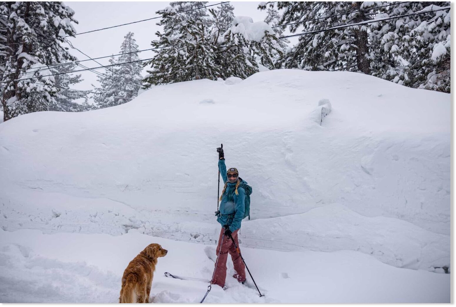
The warning is in place for 24 hours from midday today, with five to 10 centimetres of snow possible over higher ground.

The weather experts had predicted the icy conditions would start hitting across the UK from last night.

The mercury is set to fall as low as -2C in London, while temperatures could dip to -1C in Cardiff.

Edinburgh and Belfast residents are expected to feel the brunt of -3C conditions, while parts of the Scottish Highlands are set to see -10C.

Temperatures are also set to dip to -4C tomorrow in Kendal, Cumbria, and Dumfries in Scotland, Met Office maps show.

Scotland's yellow snow and ice warning is in place for almost three days after starting at 2pm yesterday and running until 10am on Wednesday.

The meteorologists' five-day forecast suggests the weather will be "turning colder with increasingly wintry showers from the north".

It expects further snow showers to fall in the north tonight with a widespread frost.

And from tomorrow it will be cold, particularly in the north, with some sharp overnight frosts throughout the week.

A warning for ice covering much of Scotland and the north-west and north-east of England suggests there could be "icy surfaces and high-ground snow leading to some difficult travelling conditions in places" this morning.

Expected "frequent wintry" snow showers have also seen the Met Office issue a lengthy warning for snow and ice for northern Scotland from today through to Wednesday.

The Met Office said: "A few centimetres of snow are likely at low levels over a given 24-hour period, with the potential for 10-15cm above 200 metres, especially across parts of the Highlands. Ice will be additional hazard, especially Tuesday night."

Residents are urged to take care as there may be some icy patches on some untreated roads, pavements and cycle paths and some roads and railways are likely to be affected with longer journey times by road, bus and train services.

The forecaster said: "By Sunday most of the UK will be in the northerly airflow, with lower temperatures spreading further south overnight.

"Showers will fall increasingly as sleet and snow in the north, even to lower levels.

"Some showers further South and West, and perhaps a more persistent spell of rain overnight into Monday, could also turn to sleet and snow mainly over high ground such as the Brecon Beacons, Exmoor and Dartmoor.

"Overnight frost will become more widespread by Monday night, with overnight temperatures below 0°C across much of the UK.

"Temperatures could get down to -10°C in sheltered glens, or across high ground areas of Scotland where there is lying snow."

The Met Office said that showers would continue on Sunday, "falling as snow in the north".

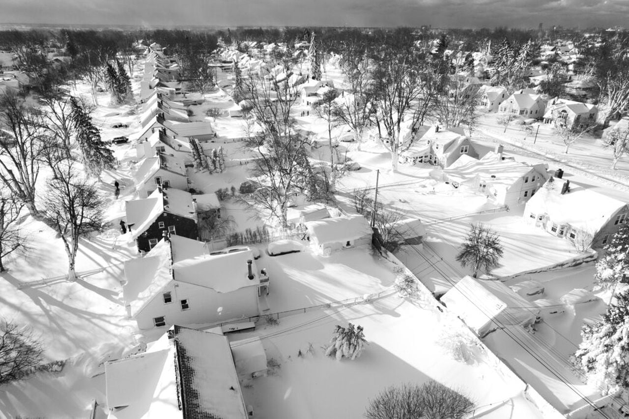
Large parts of Cumbria have already been covered ahead of a freezing week for the UK.

Snow ploughs were seen driving through the town on Nenthead to clear the roads on Sunday morning.

2023-york-uk-river-ouse-788875002.jpg

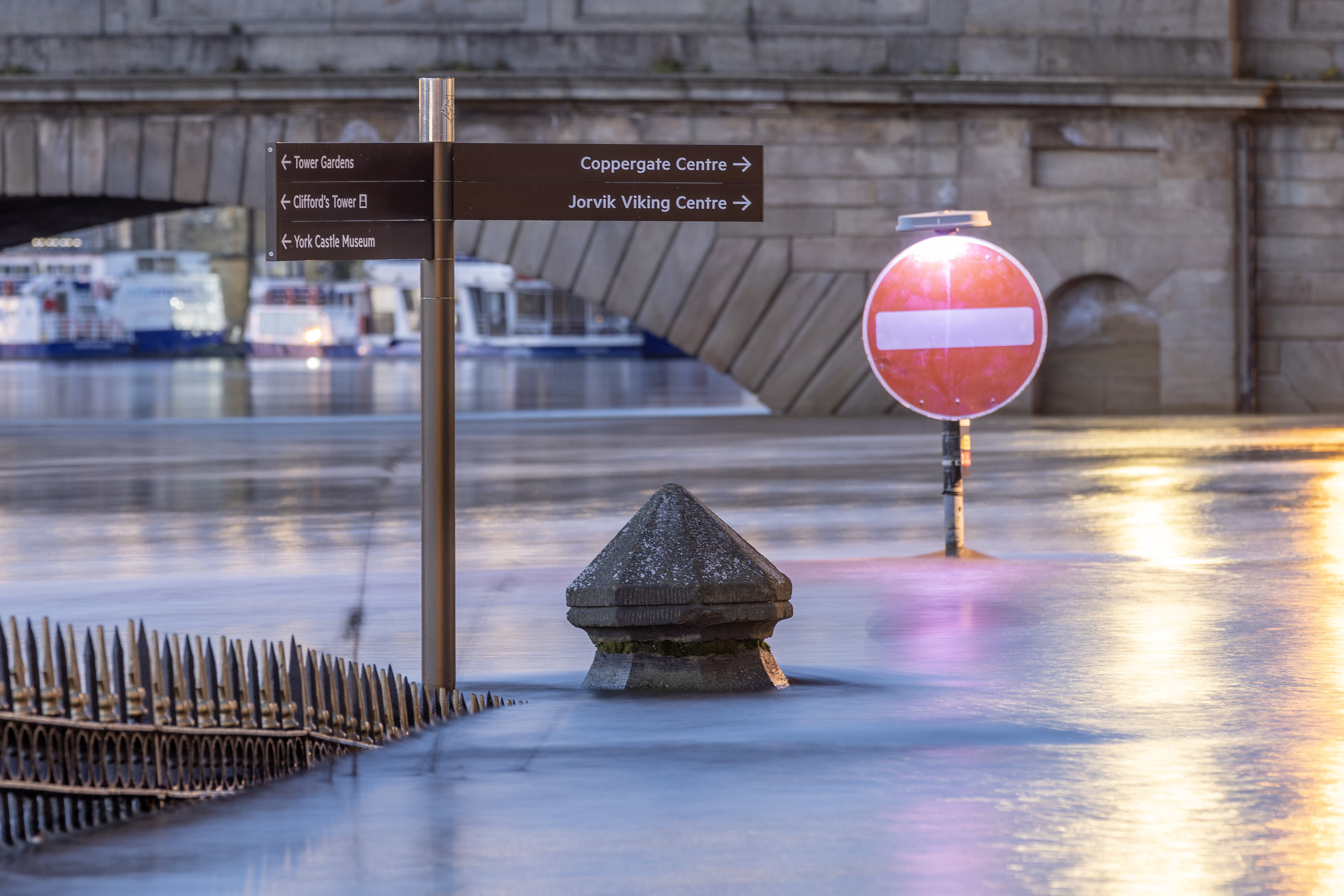
The River Ouse in York reached 4.14 metres last night flooding riverside roads and buildings Credit: LNP

Screenshot 2023-01-16 at 17-37-17 Travel chaos as snow hits in freezing -10C blast - with more...png


Screenshot 2023-01-16 at 17-51-27 Brenden Mincheff on Twitter.png
 
Last edited:
Milloy climate tweet sets Twitter abuzz; Even Musk admits he is no believer

This tweet has had 13 million views. Even Musk commented. The Twitter censors tried to ‘add context” but just showed what liars they are. Here’s my explanation and no-lose prediction for the CO2-warming hoax.

Here’s the tweet.

So here is the NOAA release

chrome_screenshot_1674045249572.png

After the release, I did the original tweet (above).

The next day and not unexpectedly, no one in the media reported that there had been no warming since 2015.

Screen-Shot-2023-01-16-at-11.24.23-AM-728x821.png

Screen-Shot-2023-01-16-at-11.26.29-AM-1-728x1111.png

Screen-Shot-2023-01-16-at-11.28.34-AM-728x584.png

And here’s the no lose part of my prediction:

  • If the El Nino steps up warming again followed by years of pause then prediction confirmed.
  • If the El Nino fails to step up warming, then CO2 warming is further debunked.
 
Back
Top Bottom