The Ice Age Cometh! Forget Global Warming!

First Blizzard of the Season Breaks October Snow Record in Havre, Montana; Up to 30 Inches Reported (Video)
https://weather.com/storms/winter/news/rockies-snow-montana-colorado-wyoming-early-october-2017

Story Highlights
* A heavy early-season snowstorm dumped more than a foot of snow on parts of the Rockies.
* Travel impacts occurred, along with tree damage and power outages.

The first blizzard of the season resulted in widespread power outages and downed trees in parts of Montana. Treacherous travel conditions and additional power outages were also observed across other portions of the northern and central Rockies as an early-season snowstorm swept through the region.

Unlike the snow the Rockies experienced in September, this storm had a greater impact since valley locations were also affected, in addition to typical mountain areas.

Havre, Montana, had seen 13 inches of heavy, wet snow as of late Tuesday afternoon, which set a new record for heaviest two-day October snowfall total at the Havre City-County Airport. The previous two-day October record was 12.6 inches, which was set in 1898.

Many large tree branches were downed, and all of Havre was without power, the Hill County Sheriff reported around 10 p.m. MDT Monday.

According to the National Weather Service in Great Falls, Montana, this storm was effectively a blizzard in the Havre area, especially considering the severe impacts. A blizzard occurs when the following conditions are met for at least three consecutive hours: sustained winds or frequent gusts to at least 35 mph and considerable falling and/or blowing snow that frequently reduces visibility to less than a quarter mile.

The heaviest estimated snow amount from this storm is 30 inches in Rocky Boy, Montana. Drifts in at least one location were estimated to be eight feet high.

Top snowfall totals as of Tuesday evening include:
•30 inches in Rocky Boy, Montana
•20.4 inches near Encampment, Wyoming
•18 inches near Steamboat Springs, Colorado
•16 inches near Cameron Pass, Colorado
•Up to 15 inches near Breckenridge, Colorado
•14 inches at the Vail Pass rest area on Interstate 70 in Colorado
•14 inches near Redcliff, Colorado
•14 inches in Zortman, Montana
•14 inches in Cut Bank, Montana
•13 inches in Havre, Montana (Havre City-County Airport)
•13 inches near Rand, Colorado
•12 inches near Laramie, Wyoming
•10 inches near Avon, Colorado

The snow first affected the Colorado Rockies Sunday night into Monday. Interstate 70 was closed in Colorado between Vail and Copper Mountain for a time Monday morning due to accidents and vehicles sliding off the icy road. Shelters were opened to take in stranded travelers in the area.

More than a foot of snow accumulated in many locations, including an estimated 14 inches of snow that was measured at the Vail Pass rest area on Interstate 70 as of Monday morning.

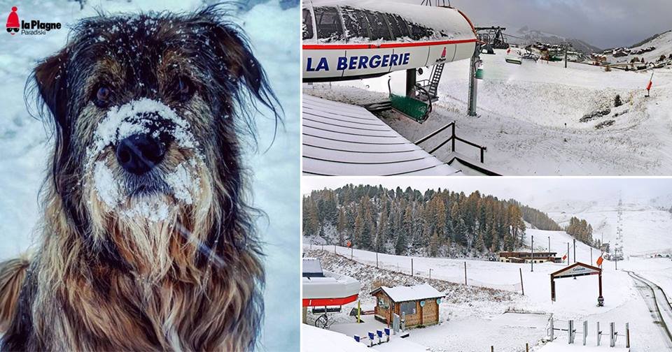
Several ski resorts in the high country of Colorado expressed their excitement about the snow.

Loveland Ski Area provided this image showing how the snow had piled up on their measuring platform at an elevation of 10,894 feet before power was knocked out there. More than a foot of snow had been measured at that location by early Monday.
 
It’s Snowing On Ski Slopes All Over The World (Photo - Video)
https://www.inthesnow.com/snowing-ski-slopes-world/

Ski areas in the Alps have reported up to 20cm of fresh snow in the past 24 hours – around 15 glacier ski areas are already open and have great conditions.

Here’s the Hintertux glacier after the fresh snow there.

And this is Val d’Isere this morning:

20cm was also reported at Mt Hutt in New Zealand in the last 24 hours leading to a highly unusual (for so late in the season) closure due to avalanche danger.

Several New Zealand ski areas have extended their seasons due to all the snow there. Today is the last day of the (also extended) winter in Australia though.

Heavy snowfall has also been reported on Mt Yotei in Japan, the stunning mountain across the slopes from Niseko.

In North America snowfall is expected in the next 24 hours down to city level in Denver. Ski areas in Colorado are also making snow aiming to open in the next week.

This was Arapahoe Basin on Friday and pictured top is Loveland’s Parker The Snow Dog getting ready for the lifts to start turning there..
 
A gigantic hole has appeared in the Antarctic ice, and scientists are baffled as to why it has formed. The hole, comparable in size to Austria or Maine, appeared without warning and without any apparent reason.

Mysterious and Monstrous Hole Appears in Antarctic Ice, Perplexing Scientists
https://sputniknews.com/environment/201710111058150263-giant-antarctic-hole-baffles-scientists/

Holes form in Antarctica all the time. They're called polynyas, and they form in the sea ice that lines the Antarctic coast. The circulation of warm water or ocean currents causes the hole to form, and the polynya usually disappears after a few months.

But this hole didn't form along the Antarctic coastline, where all the sea ice is. Instead, it's hundreds of miles inland. Speaking to Motherboard, professor of atmospheric physics Kent Moore with the University of Toronto called the massive hole "quite remarkable," like someone "punched a hole in the ice."

This is hundreds of kilometres from the ice edge. If we didn't have a satellite, we wouldn't know it was there," Moore said, adding that the polynya was 80,000 square kilometers (30,900 square miles) in area.

The same spot was the site of a polynya 40 years ago, according to Moore. However, the hole went largely unstudied due to limitations of observational instruments in the 1970s. The polynya opened back in September, according to Moore. "In the depths of winter, for more than a month, we've had this area of open water. It's just remarkable that this polynya went away for 40 years and then came back."

Moore, who is also a member of Princeton University's Southern Ocean Carbon and Climate Observations and Modelling project (SOCCOM), said that climatologists are excited for another opportunity to study the mysterious hole in the ice."Compared to 40 years ago, the amount of data we have is amazing," he said. "At that time, the scientific community had just launched the first satellites that provided images of the sea-ice cover from space."

The kneejerk for both scientists and the public is to blame the polynya on climate change, but Moore called that "premature" since the hole has recurred since the 1970s, and possibly even before that.

However, the polynya will affect oceans worldwide. "Once the sea ice melts back, you have this huge temperature contrast between the ocean and the atmosphere," he explained to Motherboard. "It can start driving convection," the process by which warm water rises to the surface of the ocean, "which can keep the polynya open once it starts."

Because of this feedback loop of warm water rising to the surface as a result of the polynya, it may be a long while before it closes again. "We don't really understand the long-term impacts this polynya will have," Moore told National Geographic.
 
Another notoriously short autumn has drawn to a close as Beijing welcomed its very first snowfall early this morning.

Snowing is Half the Battle: Beijing Receives Year's First Snowfall (Photos)
http://www.thebeijinger.com/blog/2017/10/10/beijing-receives-first-snowfall-year

Snow was reported in the Haituo Mountain area in Beijing's northern Yanqing District as well as on Mentougou Mountain, located just 100 kilometers west of the city's center. Additionally, snowfall was reported on Foye Peak southeast of the city in Hebei Province.

The snowfall in these remote areas reached 6 centimeters in some places.

As beautiful as these photographs are, it will be difficult for you to take your own; all locations receiving snowfall are situated well beyond the reach of the Beijing Metro, but this video shows what the snowfall was like.

The cold snap arrives against predictions that northern China will experience fewer chilly winds arriving from Siberia this winter, thereby exacerbating conditions for air pollution during the upcoming heating season.

However you feel about global climate trends, this year's first snowfall remains the earliest in recent history. Last year, the first snowfall arrived on Nov 21 while the year before that saw its first snow on Nov 6. And with the local climate being so arid, Beijing is sometimes "lucky" to get any snow at all, coming as late as February back in 2011 when the city broke a 60-year record for latest snowfall.

As pretty as it is, we won't be seeing any dustings of snow in the city anytime soon. The local forecast calls for rain today with light winds accompanied by a daytime high temperature of 11 degrees Celsius and a nighttime low of 7 degrees Celsius.
 
David Dilley: Definitive Dates for the Onset of Major Global Cooling (FULL 1:06:27)
Adapt 2030 Published on Oct 27, 2017

https://youtu.be/u081u7Wdf5M?rel=0
David Dilley of globalweathercycles.com and globalweatheroscillations.com provides the last piece of the puzzle to give definitive dates for the onset of major global cooling, where 2019-2020 will be the first really cold year, with another amplification in 2020-2021, bringing cold on a scale we have not seen in generations.

Mr. Dilley's research is the foundation for GWO's Natural Climate Pulse Technology and is utilized in atmospheric and climate/weather prediction models created by Mr. Dilley and Global Weather Oscillations. The Climate Pulse Technology Models are utilized to predict specific climate/weather events 4-years in advance.

Hurricane pre-season forecast from David Dilley called for major hurricanes in 2017, and was the most correct, not only this year but in the last ten years as well. Other agencies self-correct and go month by month during hurricane seasons.

The natural climate pulse of earth is governed by the PFM cycles. These cycles range from daily (ocean tides) and more importantly every 6 months, 4 years, 9 years, 18 years, 72 years, 230 years, 1200 years and 130 thousand years. Earth is currently coming off a 230 year global warming cycle and dipping into a 120 year global cooling cycle. They come approximately every 230 years and we have had 5 during the past 1000 years. The last one ended in the year 1800 and was followed by dramatic cooling and a year of no summer in 1816.

​This means look for delayed shipping into Great Lakes ports due to ice coverage, and over the next few years there will be ice in the Chesapeake Bay thick enough to require icebreakers to keep shipping lanes open. Europe will experience a nasty winter, cold and snowy eclipsing all expectations, including the UK.


Paleogeographic Reconstruction Of The Little Ice Age - Catastrophic Cosmic Ray Consequences
Oppenheimer Ranch Project Published on Oct 26, 2017

https://youtu.be/eJAM3fuLjZ8?rel=0

High elevation snow blowing
Jackson Hole WY Mountain Resort · October 26 ·
_https://www.facebook.com/jacksonhole/photos/a.95822103041.87612.24718308041/10155170626073042/?type=3&theater
22730416_10155170626073042_7444974575124672807_n.jpg


Snowfall in the Alps 25.10.17
https://www.onthesnow.com/gallery/p/photo/4504/la-plagne-oct-23-2017-id496554
496554.jpg


These Are The Deepest 'Single Day' Snow Storms Ever Recorded [State By State]
| October 25, 2017
http://unofficialnetworks.com/2017/10/25/these-are-the-deepest-single-day-snow-storms-ever-recorded-state-by-state/

Expect A Cold And Snowy November In The Western United States [Powderchasers]
October 27, 2017
http://unofficialnetworks.com/2017/10/27/expect-a-cold-and-snowy-november-in-the-western-united-states-powderchasers/
ridge-2.jpg
 
GSM Update 10/31/17 - Record Snow, Flooding, Rain & Cold - Quake Watch French Alps - Dust Storm 11:52

https://youtu.be/bEXVo4g6PGY?rel=0

Winter has come: Temperatures plunge below zero as cold snap grips Britain
Chris Baynes The Independent Mon, 30 Oct 2017 00:00 UTC
https://www.sott.net/article/365940-Winter-has-come-Temperatures-plunge-below-zero-as-cold-snap-grips-Britain

Butter Shortages, Black Death in Madagascar & Massive Hail (476)
Adapt 2030 Published on Oct 29, 2017

https://youtu.be/4D9ZvdwMK-A?rel=0

Moose Lake, Minnesota - Snow Storm B-Roll - October 27th, 2017 (1:47)
https://www.youtube.com/watch?v=Vt3wyakAj40

November 2017 Temperature Outlook: Colder Than Average in Northwest; Warmer Than Average in the South ( :pinocchio:)
By Linda Lam2 days ago _weather.com
_https://weather.com/forecast/national/news/november-2017-temperature-forecast-the-weather-company
 
Published on Nov 7, 2017


https://youtu.be/qYh1al3MmzI?rel=0
Tropical Storm "Rina" formed at 03:00 UTC on November 7, 2017 (23:00 AST, November 6) as the 17th named storm of the 2017 Atlantic hurricane season. Its remnants are expected to reach Ireland and the United Kingdom on Friday, November 10, bringing rain and gale force winds. Only 7 other hurricane seasons on record had 17+ named storms by November 6: 1933, 1969, 1995, 2005, 2010, 2011, and 2012
.
 
Jackson Hole Mountain Resort, Wyoming

Resort to open Friday after historic 100 inches of snowfall Nov 21, 2017
http://www.jhnewsandguide.com/sports/features/resort-to-open-friday-after-historic-snowfall/article_32bc2551-3b13-5896-bc13-4ce077018296.html

After historic early season snowfall, Jackson Hole Mountain Resort is pushing up its opening day.

On Friday, skiers and snowboarders will be able to access the Teton, Apres Vous and Teewinot lifts a day earlier than scheduled. The Bridger and Sweetwater gondolas, and Casper and Marmot lifts, are scheduled to open the following day.

Resort spokeswoman Anna Cole said the early push came to fruition because of the work of the resort’s operations staff and cooperation from Mother Nature.

“The tools were all in place to open up,” she said. “It’s the conditions that allowed it to happen.”

Weather station data available via the Bridger-Teton Avalanche Center reported 53 inches of snow in Rendezvous Bowl, 45 inches at the Raymer plot and 36 inches at midmountain. Over 100 inches of snow have fallen in the upper elevations, with a storm front moving in Monday night expected to drop up to 11 inches at the higher elevations.

Resort business development director Bill Lewkowitz said the amount of snow on the upper mountain is incredible.

“I did comparisons looking at other resorts, and no one has snow like us,” he said. “For the most part in the U.S., we’ve been very, very lucky.”

Cole said that in her tenure at the resort, which spans almost a decade, this is the second-largest amount of terrain that is planned to be skiable on opening weekend.

The early opening announcement also came with news of the resort being ranked the No. 1 ski resort in North America by Forbes Magazine for the seventh year in a row.

In addition to the skiing during opening weekend, other resort offerings are also available. The Aerial Tram will be spinning for scenic rides from 10 a.m. to 2 p.m. Friday and Saturday; Cafe 6,311 and the General Store will be open Friday; and Casper Restaurant and Off-Piste will open Saturday. Hoback Sports, Teton Village Sports and Jackson Hole Sports plan to have holiday gear specials and rentals.

There is no date set for the tram to open for skiing, but Cole said to expect more terrain to open by next week. And while there may be record-breaking early season snow, early season conditions do exist, she said.


CHEYENNE, Wyoming – With wind gusts topping 60 miles per hour Monday, semitractor-trailer combinations were tottering and tipping on highways near Cheyenne.

Wind gusts top 60 mph, 9 trucks topple on I-25
http://www.wyomingnews.com/news/local_news/wind-gusts-top-mph-trucks-topple-on-i/article_1bc2dcf6-ce8c-11e7-9dda-5baa8e983b17.html

A wind advisory was out most of the day for light, high-profile vehicles, such as trucks with empty cargo compartments.

But despite those warnings, nine semi-tractor-trailers had blown over on Interstate 25 between Cheyenne and the Colorado border between 9:26 a.m. and 5:15 p.m., according to Lt. David Wagener of the Wyoming Highway Patrol. The interstate was closed for about an hour around 3:30 p.m. to clean up crashes in both lanes, according to emails from the Wyoming Department of Transportation.

Two vehicles also blew over on U.S. Highway 85 between Cheyenne and Colorado, and another tipped farther north at the rest stop at milepost 47 in Meriden, Wagener said.

Camera shots from the Wyoming Department of Transportation on Monday afternoon showed semi trucks parked alongside the highway at many points on Interstate 25.

At around noon, the police scanner came alive with reports of blown-over semi trucks, one of which caught on fire.

Wagener said that in his experience, the number of semi trucks that blew over wasn’t abnormal for an especially windy day.

“I’ve seen that number before,” he said.

But on windy days like Monday, the number of crashes “depends on the wind speeds and folks that are operating those high-profile vehicles to heed warnings,” Wagener said.

According to the WYDOT website, closures to light, high-profile vehicles are issued when wind gusts top 60 miles per hour and where adequate signage is available.

The warnings are targeted at vehicles such as recreational vehicles, moving vans, campers, small trailers and lightly loaded commercial vehicles.

Not heeding the advisory can earn drivers a maximum $750 fine and/or 30 days in prison.
 
Alpes : une neige précoce pour le bonheur des skieurs Vidéo
30 novembre 2017
_https://www.francetvinfo.fr/meteo/neige/alpes-une-neige-precoce-pour-le-bonheur-des-skieurs_2492937.html

Le froid et la neige qui touchent une partie du pays font bien évidemment le plaisir des skieurs, qui ont pu profiter d'une belle couche de poudreuse. Reportage dans les Alpes

10 centimètres de neige au pied des pistes, 30 centimètres en haut... Dans la station des 7 Laux (Isère), les amateurs de glisse ont vite ressorti du placard leurs skis et snowboards. L'ouverture prématurée des pistes a permis à ceux qui avaient la chance de pouvoir se rendre sur place de profiter du domaine skiable dans des conditions privilégiées. Cette station prisée des Grenoblois a ainsi ouvert deux pistes et deux remontées mécaniques.
Une reprise joyeuse mais un peu douloureuse

Ils sont ainsi plusieurs dizaines, ce jeudi 30 novembre, a avoir fait le déplacement. Même si, selon une skieuse, cette reprise fait "un peu mal aux cuisses". Aux 7 Laux, il reste encore beaucoup de travail à accomplir avant de pouvoir ouvrir l'ensemble des 40 pistes de la station et d'accueillir non plus des dizaines, mais des milliers de skieurs.

Google Trans:

Alps: an early snow for the happiness of skiers

The cold and the snow which touch a part of the country are of course the pleasure of the skiers, who could benefit from a beautiful layer of powder. Reportage in the Alps


10 centimeters of snow at the foot of the slopes, 30 centimeters at the top ... In the 7 Laux ski resort (Isère), snowboarders quickly took their skis and snowboards out of the closet. The premature opening of the slopes allowed those lucky enough to be able to go there to enjoy the ski area in privileged conditions. This popular resort of Grenoblois has opened two tracks and two lifts.

They are thus several dozens, this Thursday, November 30, to have made the trip. Even if, according to a skier, this recovery is "a little sore thighs". At 7 Laux, there is still a lot of work to do before you can open all 40 tracks of the station and accommodate not tens, but thousands of skiers.


Ice Age Farmer Published on Nov 25, 2017
12:44

https://youtu.be/MibhvGD9-PY?rel=0

Cody Lane Teton Village, WY 83025 (11-30-17)
snowfall 1” 24 Hrs 128” This Season
_https://www.jacksonhole.com/live-mountain-cams.html
_https://www.youtube.com/watch?v=ZhH2cqsGBpw
codybowl.jpg


Got Wood?

Edit add:
Taken last night.
 

Attachments

  • Wood.jpg
    Wood.jpg
    485 KB · Views: 300
  • PB290047.JPG
    PB290047.JPG
    9.3 MB · Views: 304
'Cold Times' Indeed; Grid Down for 480,000; Folks Waking Up as Grand Solar Minimum Intensifies / 3:29
Ice Age Farmer Published on Dec 10, 2017

https://youtu.be/DzwM14N_NbQ?rel=0

UK Rare Heavy Snow London & 120 MPH Snowstorms Spawning Snow Devils / 6:07
Adapt 2030 Published on Dec 12, 2017

https://youtu.be/E3nBKIf4ENk?rel=0

GSM Update 12/13/17 - Arctic Fear Mongering - Volcano Update - Geminid Meteors / 16:06 (Links within)
Oppenheimer Ranch Project Published on Dec 13, 2017

https://youtu.be/ICwv7yWZUjw?rel=0

http://icecream.me/uploads/0bfab1ddc5488fe8261ce0afb24c6262.png
 

Attachments

  • Date 7-15-15.JPG
    Date 7-15-15.JPG
    6.8 MB · Views: 246
It is getting pretty cold in the middle part of Canada and the North - seems like snow almost across Canada. https://globalnews.ca/news/3131773/saskatoon-weather-outlook-extreme-40-wind-chills-on-saturday/

Environment Canada has continued an extreme cold warning for Saskatoon, Regina, and all of central and southern Saskatchewan for a period of extreme cold conditions expected widespread across southern Saskatchewan.

Temperatures of minus 30 to minus 35 combined with light westerly winds of 10 to 15 km/h created extreme windchill values of minus 40 to minus 45 early in the day.

-50 was what it felt like in Val Marie with wind chill Saturday morning, Saskatoon and Regina’s wind chill values fell into the -40s during the overnight period and into the day.

Winters weather seems more entrenched and uniform at this time. It is supposed to continue - from coast to coast, with the worst of it being later around the Great Lakes and East, according to the Weather Network's prediction made earlier.

----------------

Semi-interrupting this thread's message, here is brief way to deal with ice on your vehicle, especially if you have always been an ice-scrapper. If living in these cold conditions, have a look and see if this could work for you - you can keep it in your car at the ready just in case, and it might save some aches and pains.


https://youtu.be/T_vNeawn4M8?ecver=1
 
This is a live temperature map for the U.S. - It looks like one-third of the U.S. in minus temperatures?

http://vortex.plymouth.edu/uschill.gif

International Falls, Minnesota woke up to a temperature of -36F at 6 a.m. Wednesday morning breaking the previous record low for Dec. 27 of -32F set in 1924, according to the National Weather Service office in Duluth. That -36 is the actual temperature, not a wind chill!

International Falls, Minnesota drops to record low -36F Wednesday Dec 27 2017
http://www.fox9.com/weather/international-falls-record-low

According to state records, the -36 morning in International Falls is only about halfway to the state record low temperature of -60 in Tower, Minnesota on Feb. 2, 1996. The all-time record low for International Falls is -55F, set in January 1909.

Wednesday morning, low temperatures in the Twin Cities metro ranged from -7 in St. Paul to -13 in nearby Lake Elmo. Minnesota is stuck in a deep freeze with single-digital highs and subzero lows hanging around into next week.


If you plan on ringing in the new year at the annual ball drop in Times Square, expect to be cold.

Near-record cold New Year's Eve expected in New York City
http://www.fox5ny.com/news/near-record-cold-new-years-eve-expected-in-new-york-city

A severe blast of Arctic air has descended on the New York City region and temperatures will stay below the freezing mark around the clock for the rest of the year.

On New Year's Eve, the temperature is expected to drop to around 12 degrees, about 12 degrees below normal and one of the coldest on record. High temperatures leading to the holiday are expected to be colder than the typical low temperatures for those days.

Despite the cold, it is not expected to be a record for that date. In 1962 the temperature plunged to 2 degrees on New Year's Eve but that fact is little comfort for the upwards of one million people expected to spend hours outdoors waiting to ring in 2018.


How's this for a white Christmas? Erie, Pennsylvania broke a one-day snowfall record with 34 inches of snow on Christmas Day. The previous record for Dec. 25 was 8.1 inches, set in 2002, and the previous single-day snowfall record was 20 inches, set on Nov. 22, 1956.

Erie, Pennsylvania gets record 34 inches of snow in 24 hours (Video)
http://www.fox5ny.com/news/erie-pa-snow-record

By Tuesday morning, Erie International Airport had accumulated 53 inches of snow since Christmas Eve. The monthly total of 73 inches is now the most snow for December, smashing the previous record of 66.9 inches set in 1989.

But wait, there’s more! According to the National Weather Service, “additional snow accumulations of 8 to 16 inches are expected through this evening, heaviest from portions of Lake County east through northern Ashtabula and Erie County PA. Expect another 4 to 8 inches of snow from tonight through Wednesday evening with locally higher amounts possible. Snowfall rates up to 3 inches per hour are expected. This will bring the additional forecast snowfall to 1 to 2 feet now through Wednesday evening.”

Erie, Pennsylvania still fell short of the national records. Silver Lake, Colorado holds the Lower 48 record for most snowfall in 24 hours, with 75.8 inches – that’s 6.3 feet on April 15, 1921. In the mountains of Alaska, Mile 47 Camp saw 78 inches of snow in a 24-hour period ending Feb. 9, 1963.


On Tuesday, the city of Erie, Pennsylvania signed a declaration of disaster emergency, after a two-day storm dumped 5-feet of snow. Heavy lake-effect snow set record-setting snowfall totals in the snow belts to the east of Lake Ontario and Lake Erie.

Snowmageddon Dumps Record 60 Inches Of Snow On Erie, PA; "Declaration Of Disaster" (Photos)
https://www.zerohedge.com/news/2017-12-27/snowmageddon-dumps-record-60-inches-snow-erie-pa-declaration-disaster

From 7 p.m. on Dec. 24 to 6:02 p.m. Dec. 26, Erie had received 60.0 inches of snow, which shattered numerous records for the region. Nearly all of the snow fell on Monday and Tuesday.

AccuWeather Meteorologist Bill Deger said, “this is now the biggest two-day snow total on record for Pennsylvania, besting the old record of 44 inches, which was set in Morgantown from March 20-21, 1958.”

Dale Robinson, the county’s emergency management coordinator, said that the declaration will allow the National Guard to respond to the paralyzed region. Robinson adds the National Guard deployment is “really for precautionary measures for the additional amount of snow we think we’re going to get.”

As of Wednesday morning, NWS Cleveland reports additional snow will accumulate through the day with temperatures ranging from -5 and -10 degrees F. So far no sign of global warming...
 
Canada continues to get hammered by this cold weather system.

http://www.cbc.ca/news/canada/edmonton/cold-weather-edmonton-alberta-new-year-meteorologist-1.4465452?cmp=news-digests-edmonton

Extreme weather warning issued for Edmonton, much of northern and eastern Alberta

Edmonton is among a lengthy list of Alberta communities facing an extreme cold weather warning.

As of 3:34 p.m. Wednesday, Environment Canada had issued extreme cold weather warnings for communities across northern Alberta, including the provincial capital, St. Albert and Sherwood Park. The extreme cold warning stretches north to High Level and Wood Buffalo, then down the eastern part of the province, through Lloydminster to Medicine Hat in the south.

An Arctic air mass is expected to cover Alberta Wednesday night, causing temperatures to plummet to around the –40 degree mark, according to Environment Canada. Extreme cold warnings are issued when the temperature, or the wind chill, reaches the -40 C mark.


http://www.cbc.ca/news/canada/newfoundland-labrador/wind-weather-warnings-newfoundland-1.4465041?cmp=news-digests-canada-and-world-evening

Whiteout conditions hit Newfoundland's west coast as wind and snow batter island, coastal Labrador

Much of Newfoundland and parts of Labrador remain under wind and blizzard warnings from Environment Canada.

In the St. John's area, winds were between 100 and 120 km/h Wednesday, with the coast of Labrador getting the same blast.


http://www.cbc.ca/news/canada/toronto/gta-under-extreme-cold-warning-1.4465156

Deep freeze numbs GTA as Environment Canada issues extreme cold warning

Environment Canada issued a slew of extreme cold warnings on Wednesday as temperatures plummet below -15 C and a wind chill of -30 numbs the Greater Toronto Area.

The frigid temperatures and wind chill in Toronto, along with Durham, Halton and Peel regions, creates an elevated risk to health, such as frost bite and hypothermia, the federal weather agency says.

High winds will bring a low of -22 C Wednesday night, though it will feel more like -30.

Peter Kimbell, warning preparedness meteorologist for Environment Canada, predicts tonight's cold snap will edge into record-breaking territory at Toronto Pearson. The 57-year-old record for Dec. 27, measured at the airport, is -18.9 C.

Environment Canada is asking people to watch for cold-related symptoms, including shortness of breath, chest pain, muscle pain and weakness, numbness and a change in the colour of the fingers and toes.
 
Back
Top Bottom