Earthquakes around the world

WORLDWIDE EARTHQUAKE REPORT JANUARY 21/2023

Seismic activity in Indonesia increased on January 18. Six aftershocks of magnitude greater than 4.0 were recorded from the M7.0 earthquake in the Molucca Sea Indonesia.
● More aftershocks of the M7.0 earthquake in Molucca Sea Indonesia were recorded this January 21. The highest magnitude aftershock reached 5.1 at 03:58 UTC (47 km depth) and 14:06 UTC (41 km depth)

M 4.6 - 159 km WNW of Tobelo, Indonesia
M 5.1 - 155 km NW of Tobelo, Indonesia
M 4.7 - 162 km NW of Tobelo, Indonesia
M 4.5 - Molucca Sea
M 4.4 - 199 km NW of Tobelo, Indonesia
M 5.1 - 160 km NW of Tobelo, Indonesia

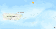
● Earthquake swarm in Charlotte Amalie, U.S. Virgin Islands, near Puerto Rico region. So far the highest magnitude earthquake in this sequence was 3.9 at 05:14 on January 21
M 3.3 - 107 km N of Charlotte Amalie, U.S. Virgin Islands
M 3.2 - 109 km N of Charlotte Amalie, U.S. Virgin Islands
M 3.2 - Puerto Rico region
M 3.4 - 113 km N of Charlotte Amalie, U.S. Virgin Islands
M 3.2 - 108 km N of Charlotte Amalie, U.S. Virgin Islands
M 3.9 - 106 km N of Charlotte Amalie, U.S. Virgin Islands
M 3.4 - 104 km N of Charlotte Amalie, U.S. Virgin Islands
M 3.8 - 109 km N of Charlotte Amalie, U.S. Virgin Islands
M 3.8 - 104 km N of Charlotte Amalie, U.S. Virgin Islands
M 3.2 - 101 km N of Charlotte Amalie, U.S. Virgin Islands
M 3.2 - 80 km N of Charlotte Amalie, U.S. Virgin Islands
M 3.2 - 76 km N of Charlotte Amalie, U.S. Virgin Islands
M 3.4 - 108 km N of Cruz Bay, U.S. Virgin Islands
M 3.7 - 123 km N of Suárez, Puerto Rico.
M 3.1 - 75 km N of Charlotte Amalie, U.S. Virgin Islands
chrome_screenshot_1674351185074.png

Earthquake swarm in Reykjanes Ridge, North Atlantic Ocean on Saturday, Jan 21

M 5.2 - Reykjanes Ridge
M 4.8 - Reykjanes Ridge
M 5.7 - Reykjanes Ridge
M 5.3 - Reykjanes Ridge

● M 5.0 - South Sandwich Islands region
2023-01-21 05:47:21 (UTC)
57.322°S 25.638°W. 35.0 km depth
USGS earthquake alert

● M 4.5 - south of Panama
2023-01-21 17:59:48 (UTC)5.041°N 82.639°W10.0 km depth
USGS earthquake alert

● Summary

Seismic activity level has been at moderate in the last 24 hours. This is the last chart posted by Volcanodiscovery at 01:00 UTC on January 22 Global seismic activity level chart
~6 quakes above magnitude 5
~52 quakes between magnitude 4 and 5
~134 quakes between magnitude 3 and 4
~216 quakes between magnitude 2 and 3
~414 quakes below magnitude 2 that people normally don't feel.
~822 earthquakes in the past 24h (783 earthquakes in the 24 hours prior to this report) Estimated combined seismic energy release: 14002 tons of TNT or 0.9 atomic bombs.
Volcanodiscovery earthquake report 24h
 
Last week saw 1 M7, being a M7.6 in Indonesia and 1 M6 (M6.0).
In the usual area, there were 4 out of 87 earthquakes worldwide equal to or greater than 4.5 and 1209 out of 1569 quakes of all sizes.
Percentage: 77.1%
Last week saw 1 M7 (M7.0 in Indonesia) and 5 M6 with the highest of those being a M6.8 in Argentina.
In the usual area, there were 4 out of 128 earthquakes worldwide equal to or greater than 4.5 and 1407 out of 1788 quakes of all sizes.
Percentage: 78.7%
Earthquakes 7 days to Jan 22nd 2023.gif
 
WORLDWIDE EARTHQUAKE REPORT JANUARY 22/2023

● M 5.0 - Tonga
2023-01-22 02:48:37 (UTC)
21.009°S 173.755°W. 10.0 km depth
USGS earthquake alert

● M 5.0 - 108 km SSE of Panguna, Papua New Guinea
2023-01-22 20:13:42 (UTC)
7.166°S 155.973°E. 117.2 km depth
USGS earthquake alert

● M 4.6 - Greece
2023-01-22 04:46:47 (UTC)
38.860°N 22.922°E. 10.1 km depth
USGS earthquake alert
Moderate mag. 4.6 earthquake, Aegean Sea, 42 km east of Lamia (pop: 52,000) Phthiotis, Central Greece, on Sunday, Jan 22, 2023 at 6:46 am local time. Sousaki is the nearest volcano located at 95 km from epicenter. Sousaki volcano is stressed by many fault systems that are a cause of high seismic activity in the area of Gerania mountains and the Loutraki thermal spings are probably also connected to the "Sousaki magma chamber". The area is controlled by the Greek Geological Instistute IGME.

● M 4.5 - Guatemala
2023-01-22 22:08:55 (UTC)
14.089°N 91.413°W. 76.5 km depth
USGS earthquake alert
Light magnitude 4.5 earthquake 17 km (11 mi) SW of Concepcion (Nueva Concepción, Escuintla) (pop: 11,100) Guatemala, on Sunday, Jan 22, 2023 at 4:08 pm local time. Atitlan is the nearest volcano located at 60 km from epicenter

● Earthquake Forecast: Critical planetary geometry from 19 to 22 January has the potential to trigger strong to major seismic activity, most likely 20-24 January.

MAGNITUDE PROBABILITY

updated 21 January 2023, 10:43 UTC

M 6.0-6.4M 6.5-6.9M 7.0-8.4M 8.5+
70%60%60%50%

Atmospheric fluctuations thus far seem to point to the Americas and to parts of Asia.
Larger seismic activity may occur at or after the lunar peak on 23 January, that follows on the sequence of planetary conjunctions from 19 to 22 January.

● Summary

Seismic activity level has been at low levels in the last 24 hours. This is the last chart posted by Volcanodiscovery at 01:30 UTC on January 23 Global seismic activity level chart
~2 quakes above magnitude 5
~38 quakes between magnitude 4 and 5
~91 quakes between magnitude 3 and 4
~237 quakes between magnitude 2 and 3
~359 quakes below magnitude 2 that people normally don't feel.
~727 earthquakes in the past 24h (822 earthquakes in the 24 hours prior to this report) Estimated combined seismic energy release: 4953 tons of TNT or 0.3 atomic bombs.
Volcanodiscovery earthquake report 24h
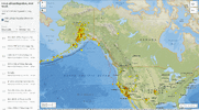
 
WORLDWIDE EARTHQUAKE REPORT JANUARY 23/2023

●M 5.5 - 162 km NW of Tobelo, Indonesia
2023-01-23 18:17:34 (UTC)
2.881°N 127.100°E. 12.0 km depth
USGS earthquake alert
● M 5.0 - Molucca Sea
2023-01-23 17:06:49 (UTC)
2.752°N 126.938°E. 35.1 km depth
USGS earthquake alert
Aftershocks from the M7.0 quake in Molucca Sea, 291 km northeast of Manado, North Sulawesi, Indonesia on January 18, 2023 continue. Two shallow earthquakes hit Molucca Sea Indonesia region.

● M 5.2 - Volcano Islands, Japan region
2023-01-23 02:59:43 (UTC)
23.513°N 142.916°E. 40.9 km depth
USGS earthquake alert
Moderate magnitude 5.2 earthquake in North Pacific Ocean 404 km (251 mi) S of Futami (pop: 897) Japan, on Monday, Jan 23, 2023 at 12:59 pm local time. Nikko is the nearest volcano located at 79 km from epicenter.
Nikko volcano is a large submarine volcano in the Volcano Islands chain of Japan.

● M 5.1 - South Sandwich Islands region
2023-01-23 03:02:03 (UTC)
57.695°S 23.670°W. 10.0 km depth
USGS earthquake alert

● M 5.1 - 92 km SSW of Qrendi, Malta
2023-01-23 10:37:52 (UTC)
35.033°N 14.193°E. 10.0 km depth
USGS earthquake alert
An strong earthquake of magnitude 5.1 occurred 92 km (57 mi) SSW of Żurrieq (pop: 9,150) Malta. The quake hit at a shallow depth of 10 km beneath the epicenter, in the morning on Monday, January 23rd, 2023, at 11:37 am local time.

● M 5.1 - Manipur, India region
2023-01-23 13:42:03 (UTC)
24.813°N 93.027°E. 10.0 km depth
USGS earthquake alert
A strong earthquake magnitude 5.1 occurred 7 km (5 mi) N of Lakhipur (pop: 12,900) India
The quake hit at a shallow depth of 10 km beneath the epicenter near Silchar, Cachar, Assam, India, early evening on Monday, January 23rd, 2023, at 6:42 pm local time.

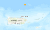
In the last few days Puerto Rico has been shaken by earthquakes of between three and four magnitude. On January 23 Puerto Rico felt a seismic swarm, the largest of these had a magnitude of 4.0 at 05:37 UTC.

M 3.0 - Puerto Rico region
M 3.6 - 11 km SSE of Guánica, Puerto Rico
M 4.0 - 116 km N of Suárez, Puerto Rico
M 3.9 - 123 km N of Suárez, Puerto Rico
M 3.9 - 88 km N of Suárez, Puerto Rico
M 3.5 - 2 km SSE of Boquerón, Puerto Rico
M 3.4 - Puerto Rico region
chrome_screenshot_1674524787020.png

● Summary

Seismic activity level has been at moderate levels in the last 24 hours. This is the last chart posted by Volcanodiscovery at 01:40 UTC on January 24 Global seismic activity level chart
~6 quakes above magnitude 5
~27 quakes between magnitude 4 and 5
~88 quakes between magnitude 3 and 4
~217 quakes between magnitude 2 and 3
~403 quakes below magnitude 2 that people normally don't feel.
~741 earthquakes in the past 24h (727 earthquakes in the 24 hours prior to this report) Estimated combined seismic energy release: 7708 tons of TNT or 0.5 atomic bombs.
Volcanodiscovery earthquake report 24h
 
Strong and very deep earthquake

M 6.4 - 33 km WSW of Campo Gallo, Argentina
2023-01-24 18:37:00 (UTC)
26.689°S 63.165°W. 601.0 km depth
USGS earthquake alert
Strong magnitude 6.4 earthquake - 33 km west of Campo Gallo, Departamento de Alberdi, Santiago del Estero (pop 5,460) Argentina, on Tuesday, Jan 24, 2023 at 3:37 pm local time
This quake was likely an aftershock of the 6.8 quake Santiago Del Estero Prov., Argentina, Jan 20, 2023 7:09 pm

Data for the same earthquake reported by different agencies

Mag.DepthLocationSource
6.4601 kmSantiago Del Estero Prov., ArgentinaUSGS
6.1584 kmSANTIAGO DEL ESTERO, ARGENTINAEMSC
6.4601 kmSantiago Del Estero Prov., ArgentinaRaspberry
Shake
5.8535 kmArgentina: Near TucumánRENASS
6.2596 kmSantiago Del Estero Province, Argentina [Land: Argentina]INGV
6.1586 km33 Km WSW of Campo Gallo, ArgentinaGFZ
6.4579 kmSantiago Del Estero Prov., ArgentinaGeoAu
6.410 kmArgentina: Santiago Del Estero Prov., Arg.IRIS
Volcanodiscovery
 
WORLDWIDE EARTHQUAKE REPORT JANUARY 24/ 2023

Several aftershocks of the M7.1 earthquake of January 18 in the Molucca Sea, Indonesia, were recorded in the past 24 hours. The highest magnitude aftershock recorded 5.8

● M 5.8 - 168 km NW of Tobelo, Indonesia
2023-01-24 02:13:14 (UTC)
2.816°N 126.943°E. 35.0 km depth
USGS earthquake alert

● M 5.5 - 189 km NW of Tobelo, Indonesia
2023-01-24 20:17:53 (UTC)
3.155°N 127.059°E. 3.4 km depth
USGS earthquake alert

● M 5.4 - 167 km NW of Tobelo, Indonesia
2023-01-24 02:30:04 (UTC)
2.949°N 127.112°E. 35.0 km depth
USGS earthquake alert

● M 5.2 - 208 km NNE of Tobelo, Indonesia
2023-01-24 16:10:15 (UTC)
3.538°N 128.547°E. 10.0 km depth
USGS earthquake alert

● M 5.1 - Molucca Sea
2023-01-24 01:10:21 (UTC)
2.765°N 126.912°E. 20.0 km depth
USGS earthquake alert

M 4.6 - 161 km NW of Tobelo, Indonesia
M 4.5 - 167 km NW of Tobelo, Indonesia
M 4.9 - 159 km NW of Tobelo, Indonesia
M 4.5 - 149 km NW of Tobelo, Indonesia
M 4.5 - 170 km NW of Tobelo, Indonesia
M 4.3 - 164 km NW of Tobelo, Indonesia
M 4.5 - 166 km NW of Tobelo, Indonesia
M 4.7 - 148 km NW of Tobelo, Indonesia
M 4.5 - 164 km NW of Tobelo, Indonesia
M 4.9 - 187 km NW of Tobelo, Indonesia
M 4.4 - Molucca Sea
M 4.5 - 157 km NNW of Tobelo, Indonesia

● M 5.6 - Nepal
2023-01-24 08:58:32 (UTC)
29.597°N 81.652°E. 25.2 km depth
USGS earthquake alert
Strong mag. 5.6 earthquake - 78 km northeast of Dipayal (pop: 23,400) Doti, Sudurpashchim Pradesh, Nepal, on Tuesday, Jan 24, 2023 at 2:28 pm
This earthquake occurred in the zone (purple band) indicated with potential for strong seismic activity 5 days ago.

● M 5.3 - 105 km S of Żurrieq, Malta
2023-01-24 20:25:34 (UTC)
34.891°N 14.328°E. 10.0 km depth
USGS earthquake alert
Strong activity continues in the Mediterranean region. A magnitude 5.3 earthquake 105 km (66 mi) S of Żurrieq (pop: 9,150) Malta the earthquake occurred at a shallow depth of 10 km beneath the epicenter in the evening on Tuesday, January 24th, 2023, at 9:25 pm local time

530 days (1 year, 5 months, 12 days) have passed without an M8.0+ earthquake. The last one occurred in the South Sandwich Islands on August 12, 2021 with a magnitude M8.1

● Summary

Seismic activity level has been at high levels in the last 24 hours. This is the last chart posted by Volcanodiscovery at 01:40 UTC on January 25 Global seismic activity level chart
~1 quake above magnitude 6
~7 quakes between magnitude 5 and 6
~38 quakes between magnitude 4 and 5
~114 quakes between magnitude 3 and 4
~263 quakes between magnitude 2 and 3
~482 quakes below magnitude 2 that people normally don't feel.
~905 earthquakes in the past 24h (741 earthquakes in the 24 hours prior to this report) Estimated combined seismic energy release: 84104 tons of TNT or 5.3 atomic bombs
Volcanodiscovery earthquake report 24h
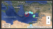
 
Strong activity continues in the Mediterranean region.

M 5.9 - 62 km SE of Lárdos, Greece
2023-01-25 12:37:05 (UTC)
35.776°N 28.593°E. 25.9 km depth
USGS earthquake alert
An earthquake of magnitude 5.9 occurred early afternoon on Wednesday, January 25th, 2023, at 2:37 pm local time at 79 km (49 mi) SSE of Rhodos (pop: 56,100) Dodekánisos, South Aegean, Greece, as reported by the National Observatory of Athens (NOA).
According to preliminary data, the quake was located at a shallow depth of 10 km. Shallow earthquakes are felt more strongly than deeper ones.
chrome_screenshot_1674671541421.png
 
WORLDWIDE EARTHQUAKE REPORT JANUARY 24/ 2025

● M 5.2 - 63 km E of Namie, Japan
2023-01-25 01:00:48 (UTC)
37.595°N 141.705°E. 39.6 km depth
USGS earthquake alert
An earthquake of magnitude 5.2 occurred in the morning on Wednesday, January 25th, 2023, at 10:00 am local time, 61 km (38 mi) ENE of Namie (Futaba-gun) (pop: 21,900) near Iwaki, Iwaki-shi, Fukushima, Japan, as reported by Japan's National Research Institute for Earth Science and Disaster Resilience (NIED) the quake was located at a moderately shallow depth of 39 km

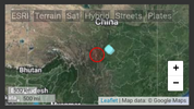
Two strong and shallow earthquakes hit China on January 25.

● M 5.5 - 27 km SSE of Kangding, China
2023-01-25 19:49:45 (UTC)
29.766°N 102.047°E. 10.0 km depth
USGS earthquake alert
Strong magnitude 5.5 earthquake 28 km (17 mi) SSE of Kandin (pop: 100,000) The quake hit at a shallow depth of 10 km beneath the epicenter near Kandin, Garzê, Sichuan, China, early morning on Thursday, January 26th, 2023, at 3:49 am local time.
chrome_screenshot_1674695695491.png


● M 5.3 - 146 km S of Hotan, China
2023-01-25 16:02:10 (UTC)
35.789°N 79.862°E. 10.0 km depth
USGS earthquake alert
Strong magnitude 5.3 earthquake, 147 km south of Chotan, Hotan Diqu (pop 419,200), Xinjiang, China, on Thursday, Jan 26, 2023 at 12:02 am local time
chrome_screenshot_1674695251879.png

● M 5.0 - Kermadec Islands region
2023-01-25 15:09:34 (UTC)
31.451°S 178.195°W. 37.8 km depth
USGS earthquake alert

M 5.0 - Kermadec Islands region
2023-01-25 20:13:06 (UTC)
28.352°S 175.980°W. 10.0 km depth
USGS earthquake alert

● M 4.6 - 41 km SSW of Puerto El Triunfo, El Salvador
2023-01-25 05:15:30 (UTC)
12.946°N 88.727°W. 67.4 km depth
USGS earthquake alert
Light magnitude 4.6 earthquake - North Pacific Ocean, 97 km southeast of San Salvador, 42 km (26 mi) SSW of Puerto El Triunfo (pop: 19,100) on Tuesday, Jan 24, 2023 at 11:15 pm local time.

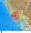
● M 4.2 - 16km S of Malibu Beach, CA
2023-01-25 10:00:54 (UTC)
33.885°N 118.705°W. 14.7 km depth
USGS earthquake alert
An earthquake of magnitude 4.2 occurred early morning on Wednesday, January 25th, 2023, at 2:00 am local time 17 km (11 mi) SSE of Malibu (pop: 13,000) near Santa Monica, Los Angeles County, California, USA, as reported by the United States Geological Survey. Aftershocks:
M 3.6 - 16km S of Malibu Beach, CA
M 2.9 - 17km S of Malibu Beach, CA
M 2.8 - 15km S of Malibu Beach, CA

● Earthquake Forecast: Larger seismic activity may occur around the second lunar peak on 26 January, that follows on the sequence of planetary conjunctions from 19 to 22 January. Seismic activity can potentially reach high 7 magnitude.

MAGNITUDE PROBABILITY

updated 25 January 2023, 11:44 UTC
M 6.0-6.4M 6.5-6.9M 7.0-8.4M 8.5+
70%70%70%60%

● Summary

Seismic activity level has been at moderate levels in the last 24 hours. This is the last chart posted by Volcanodiscovery at 00:40 UTC on January 26 Global seismic activity level chart
~5 quakes above magnitude 5
~40 quakes between magnitude 4 and 5
~128 quakes between magnitude 3 and 4
~229 quakes between magnitude 2 and 3
~441 quakes below magnitude 2 that people normally don't feel.
~843 earthquakes in the past 24h (905 earthquakes in the 24 hours prior to this report) Estimated combined seismic energy release: 18854 tons of TNT or 1.2 atomic bombs
Volcanodiscovery earthquake report 24h
 
As always the sessions nailed it! 🎯


Screenshot 2023-01-26 at 07-42-46 Session 10 January 2015.png

FnT03psWYAU65kB.png
 
Strong earthquake

M 6.0 - Kermadec Islands, New Zealand
2023-01-26 10:45:53 (UTC)
30.254°S 178.669°W. 135.7 km depth
USGS earthquake alert
Strong magnitude 6.0 earthquake - South Pacific Ocean, New Zealand, on Thursday, Jan 26, 2023 at 11:45 pm local time

Data for the same earthquake reported by different agencies
Mag.DepthLocationSource
5.8111 kmNew ZealandGEONET (NZ)
5.9108 kmKermadec Islands, New ZealandGFZ
5.810 kmNew Zealand: Near AucklandRENASS
5.6100 kmKERMADEC ISLANDS, NEW ZEALANDEMSC
6.0136 kmKermadec Islands, New ZealandRaspberry
Shake
6.0136 kmKermadec Islands, New ZealandUSGS
6.0121 kmKermadec Islands, New ZealandGeoAu
6.010 kmKermadec Islands, New ZealandIRIS
6.03.9 kmKermadec Islands, New Zealand [Sea: New Zealand]INGV
Volcanodiscovery
 
WORLDWIDE EARTHQUAKE REPORT JANUARY 26/2023

M 5.3 - Cape Verde
2023-01-26 04:16:05 (UTC)
16.608°N 25.621°W. 10.0 km depth
USGS earthquake alert
A magnitude 5.3 earthquake near Mindelo, Sao Vicente (pop.70,600) Cape Verde, The earthquake occurred at a shallow depth of 10 km beneath the epicenter early morning on Thursday, January 26th, 2023, at 3:16 am local time. Sao Vicente is the nearest volcano located at 74 km from epicenter. Sao Vicente volcano is currently dormant.

● M 5.7 - 171 km NW of Tobelo, Indonesia
2023-01-26 04:23:51 (UTC)
2.873°N 126.965°E35.0 km depth
USGS earthquake alert
New aftershock from the earthquake M7.1 in Molucca Sea. Strong magnitude 5.7 earthquake 282 km northeast of Manado, North Sulawesi, Indonesia, on Thursday, Jan 26, 2023 at 1:23 pm local time

● M 5.1 - 203 km SSE of Atka, Alaska
2023-01-26 16:41:36 (UTC)
50.661°N 172.608°W. 10.0 km depth
USGS earthquake alert
Strong magnitude 5.1 earthquake, North Pacific Ocean, 126 mi southeast of Atka (pop. 64), Aleutians West, Alaska, USA, on Thursday, Jan 26, 2023 at 4:41 am

● M 5.2 - Reykjanes Ridge
2023-01-26 19:17:03 (UTC)
57.376°N 33.374°W. 10.0 km depth
USGS earthquake alert

● M 5.3 - Reykjanes Ridge
2023-01-26 19:30:46 (UTC)
57.338°N 33.260°W10.0 km depth
USGS earthquake alert

● M 4.6 - 77 km SSE of Kadzhi-Say, Kyrgyzstan
2023-01-27 00:10:43 (UTC)
41.473°N 77.428°E. 10.0 km depth
USGS earthquake alert

Earthquake Forecast: Some stronger seismic activity may occur in the next two days due to a convergence of planetary and lunar geometry on 25-26 January. There is still a slight possibility of a major seismic event, but it is less likely.

● Summary

Seismic activity level has been at moderate levels in the last 24 hours. This is the last chart posted by Volcanodiscovery at 00:30 UTC on January 27 Global seismic activity level chart
~1 quake magnitude 6
~6 quakes above magnitude 5
~39 quakes between magnitude 4 and 5
~116 quakes between magnitude 3 and 4
~242 quakes between magnitude 2 and 3
~465 quakes below magnitude 2 that people normally don't feel.
~869 earthquakes in the past 24h (843 earthquakes in the 24 hours prior to this report) Estimated combined seismic energy release: 21367 tons of TNT or 1.3 atomic bombs
Volcanodiscovery earthquake report 24h
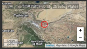


Updated to 3.1 meg Map 🤔
~1 quake magnitude 6


4500 Tremors Cascadia Subduction Zone Since Jan 1. West Coast earthquake update 1/26/2023

 
Canary Islands, outside of W Africa, Spain
27 Jan 2023

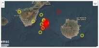
An earthquake swarm appears among the Canary Islands, between Tenerife and Gran Canaria.

cana-1.jpg


German Vulkane.net writes following:

Since noon today, there have been more than 30 tremors between the Canary Islands of Tenerife and Gran Canaria. Not counted are microquakes with magnitudes smaller than 1.5. The strongest tremor reached M 2.6 and had a hypocentre at a depth of 39 km. The epicentre was located 37 km east of Granadilla de Abona. The earthquake region is seismically preloaded, as comparable swarm earthquakes have often occurred there in recent years. A fault zone runs along the seabed, but there is also a submarine volcano named Enmedio. It cannot be ruled out that the quakes are related to magma uplift. The depth of the earthquake foci would suggest this.

END OF ARTICLE
 
Back
Top Bottom