http://spaceweather.com/ said:A NEW KIND OF SPRITE? Barely 30 years ago, many researchers did not believe that upper atmospheric lightning existed—until 1989 when researchers from the University of Minnesota captured them on video tape. Now there is a menagerie of accepted forms: sprites, elves, gigantic jets, gnomes. These "transient luminous events" (TLEs) appear above thunderclouds, reaching toward space rather than lancing down to the ground like regular lightning.
On Aug.14th, Thomas Ashcraft may have spotted a new kind of sprite. "I was photographing a cluster of sprites over a thunderstorm in western Oklahoma when something curved snaked up behind the main cluster." This frame from his video of the event shows the strange form:
https://vimeo.com/229598597?byline=0&portrait=0
What was it? Experts aren't sure.
Lightning researcher Oscar van der Velde at the Technical University of Catalonia says it could be a troll—a type of TLE that sometimes appears underneath sprites, crawling up tendrils dangling beneath the luminous clusters. "I have recorded many trolls," says van der Velde, "but never such weird curving ones. This is a really exceptional display."
Jozsef Bo'r of the Geodetic and Geophysical Research Institute in Hungary thinks it might be a type of gigantic jet. Gigantic jets are like sprites on steroids—powerful and bright. "A working hypothesis is that the red sprites in the photo occurred first and deposited a cloud of positive charge above the thundercloud. A subsequent gigantic jet was itself rich in positive charge and had to bend around the positive cloud on its way up."
Or it could be something unprecedented. "Even after almost 30 years of sprite observations, we are still seeing new things," says Walter Lyons, past president of the American Meteorological Society and a longtime observer of sprites. "Over the years I have seen thousands of sprites, but only a few curved structures like this -- so this is pretty rare."
"I don't know what to call them," says Ashcraft, who regularly monitors the sky around his private observatory in New Mexico for strange phenomena, "but I am going to keep my eyes open for more."
You are using an out of date browser. It may not display this or other websites correctly.
You should upgrade or use an alternative browser.
You should upgrade or use an alternative browser.
Crazy Storm Weather and Lightning - Global
- Thread starter mabar
- Start date
The Vulture's never miss a beat. 
https://youtu.be/vRXhWWwy7kE
Haiti's earthquake generated a $9bn response – where did the money go?
Monday 14 January 2013 10.44 GMT
https://www.theguardian.com/global-development/poverty-matters/2013/jan/14/haiti-earthquake-where-did-money-go
Uncertainty about the scale and outcome of spending following Haiti tragedy highlights need for greater transparency
Snip:
Presidents Obama, Bush, & Clinton: Help for Haiti (14:25)
The Obama White House Published on Jan 16, 2010
https://youtu.be/jta-4JLawYI
https://youtu.be/vRXhWWwy7kE
Haiti's earthquake generated a $9bn response – where did the money go?
Monday 14 January 2013 10.44 GMT
https://www.theguardian.com/global-development/poverty-matters/2013/jan/14/haiti-earthquake-where-did-money-go
Uncertainty about the scale and outcome of spending following Haiti tragedy highlights need for greater transparency
Snip:
We found that about 94% of humanitarian funding went to donors' own civilian and military entities, UN agencies, international NGOs and private contractors. In addition, 36% of recovery grants went to international NGOs and private contractors. Yet this is where the trail goes cold – you can look at procurement databases to track primary contract recipients, but it is almost impossible to track the money further to identify the final recipients and the outcomes of projects.
Presidents Obama, Bush, & Clinton: Help for Haiti (14:25)
The Obama White House Published on Jan 16, 2010
https://youtu.be/jta-4JLawYI
angelburst29
The Living Force
c.a. said:The Vulture's never miss a beat.
<snip>
Presidents Obama, Bush, & Clinton: Help for Haiti (14:25)
The Obama White House Published on Jan 16, 2010
https://youtu.be/jta-4JLawYI
Five ex-US presidents join forces to support Harvey victims
https://www.aol.com/article/news/2017/09/07/five-ex-us-presidents-join-forces-to-support-harvey-victims/23201075/
The presidents will launch “One America Appeal,” to start collecting funds with a plea broadcast during Thursday night’s National Football League season opener, the group said in a statement. Former presidents Barack Obama, George W. Bush, Bill Clinton, George H.W. Bush and Jimmy Carter are behind the effort.
angelburst29
The Living Force
Hurricane Irma is so powerful, it sucked the ocean away from beaches in the Bahamas on Friday.
Hurricane Irma Sucked The Ocean Away From Beaches In The Bahamas (Videos)
https://www.yahoo.com/news/hurricane-irma-sucked-ocean-away-032624546.html
The Washington Post’s deputy weather editor, confirmed this phenomenon is real and may occur during extremely powerful hurricanes such as Irma. The storm is so powerful, it can essentially change the shape of the ocean, Fritz said.
“Basically, Hurricane Irma is so strong and its pressure is so low, it’s sucking water from its surroundings into the core of the storm,” Fritz wrote.
“In the center of the storm, where there is extreme low pressure, water is drawn upward. Low pressure is basically a sucking mechanism — it sucks the air into it, and when it’s really low, it can change the shape of the surface of the ocean. As the storm draws water toward the center, it gets pulled away from the surroundings.”
Wayne Neely, a forecaster with the Bahamas’ Department of Meteorology, warned residents of Long Island and Exuma, where water had also reportedly receded from the beaches, to be careful as the ocean returned back to high levels.
“Care must be taken in this case because the water often returns with even greater fury,” Neely said in a Facebook post explaining the phenomenon.
People who had seen the water recede in the Bahamas on Friday said the water returned the next day.
Water empties from bay in Tampa, but folks warned: stay out
https://www.yahoo.com/news/water-empties-bay-tampa-folks-warned-stay-201745832.html
On Bayshore Boulevard in Tampa, about 100 people were walking Sunday afternoon on what was Old Tampa Bay — a body of water near downtown. Hurricane Irma's winds and low tide have pushed the water unusually far from its normal position. Some people are venturing as far as 200 yards (180 meters) out to get to the water's new edge. The water is normally about 4 to 5 feet (1 to 1.5 meters) deep and reaches a seawall.
The U.S. Hurricane Center has sent out an urgent alert warning of a "life-threatening storm surge inundation of 10 to 15 feet (3 to 5 meters) above ground level" and telling people to "MOVE AWAY FROM THE WATER!"
The waters retracted because the leading wind bands of Irma whipped the coastal water more out to sea. But once the eye passes and the wind reverses, the water will rush back in.
Hurricane Irma Sucked The Ocean Away From Beaches In The Bahamas (Videos)
https://www.yahoo.com/news/hurricane-irma-sucked-ocean-away-032624546.html
The Washington Post’s deputy weather editor, confirmed this phenomenon is real and may occur during extremely powerful hurricanes such as Irma. The storm is so powerful, it can essentially change the shape of the ocean, Fritz said.
“Basically, Hurricane Irma is so strong and its pressure is so low, it’s sucking water from its surroundings into the core of the storm,” Fritz wrote.
“In the center of the storm, where there is extreme low pressure, water is drawn upward. Low pressure is basically a sucking mechanism — it sucks the air into it, and when it’s really low, it can change the shape of the surface of the ocean. As the storm draws water toward the center, it gets pulled away from the surroundings.”
Wayne Neely, a forecaster with the Bahamas’ Department of Meteorology, warned residents of Long Island and Exuma, where water had also reportedly receded from the beaches, to be careful as the ocean returned back to high levels.
“Care must be taken in this case because the water often returns with even greater fury,” Neely said in a Facebook post explaining the phenomenon.
People who had seen the water recede in the Bahamas on Friday said the water returned the next day.
Hurricane Irma has pushed water out of a bay in Tampa, but forecasters are telling people not to venture out there, because it's going to return with a potentially deadly vengeance.
Water empties from bay in Tampa, but folks warned: stay out
https://www.yahoo.com/news/water-empties-bay-tampa-folks-warned-stay-201745832.html
On Bayshore Boulevard in Tampa, about 100 people were walking Sunday afternoon on what was Old Tampa Bay — a body of water near downtown. Hurricane Irma's winds and low tide have pushed the water unusually far from its normal position. Some people are venturing as far as 200 yards (180 meters) out to get to the water's new edge. The water is normally about 4 to 5 feet (1 to 1.5 meters) deep and reaches a seawall.
The U.S. Hurricane Center has sent out an urgent alert warning of a "life-threatening storm surge inundation of 10 to 15 feet (3 to 5 meters) above ground level" and telling people to "MOVE AWAY FROM THE WATER!"
The waters retracted because the leading wind bands of Irma whipped the coastal water more out to sea. But once the eye passes and the wind reverses, the water will rush back in.
‘No 100% safety’: Florida toxic materials could leak as Irma hits, EPA ‘aggressively’ securing sites: https://www.rt.com/usa/402837-florida-superfund-toxic-sites-irma/
http://abcnews.go.com/US/hurricane-irma-forecast-strike-florida-keys-category/story?id=49697542
4 dead as Hurricane Irma rocks Florida, leaving 3.5mn without power (VIDEOS): https://www.rt.com/usa/402850-florida-hurricane-irma-dead/
Scores of Environmental Protection Agency staff have been working to secure equipment and isolate hazardous materials at Florida’s 54 Superfund sites in the hours before Hurricane Irma made landfall – two weeks after similar sites were damaged by Hurricane Harvey.
Superfund sites are heavily contaminated former industrial zones.
The EPA “can’t guarantee it 100 percent,” that there will not be contamination following the storm, Senator Marco Rubio told AP Saturday night, but reassured the media that federal agents were “generally positive” about their preparation efforts.
“EPA feels they got a handle on it. They think that the risk is real but certainly not as severe as some other places. Not to minimize it – it’s something to think about,” said the Republican politician.
Potential leaks could poison water and soil and cause damage to humans or wildlife, or, at the very least, require expensive clean-up operations.
This week, the EPA said it had sent more than 80 staff to Florida, compared to over 200 for Texas, but nonetheless hoped to be more proactive.
"Operationally, we’ve tried to make sure we apply the same type of approach we used in Texas. Because of the area and the amount of population that’s affected in Florida, we’re trying to be even more aggressive," US environmental chief Scott Pruitt said Thursday.
AP said its reporters personally inspected six Superfund sites nearest to Irma’s point of impact and found no work going on at any of them. Barrels containing what appeared to be contaminants were left out in plain sight. When questioned about this, the EPA responded that if “there is no activity, a site should be considered secured but would be closely monitored.”
“If any site in the path of the storm is found to pose an immediate threat to nearby populations, EPA will immediately alert and work with state and local officials and inform the public – and then take any appropriate steps to address the threat,” EPA spokesperson Liz Bowman said Friday. “So far no sites have risen to this level that we are aware of.”
A recent study published by the Government Accountability Office said water levels of 1 to 4 feet above the ground could be sufficient to flood Florida’s most vulnerable sites. The National Hurricane Center has predicted that storm surges may reach 15 feet.
Although Hurricane Harvey flooded 13 Superfund sites, the EPA says that inspections, some precautionary, of 58 sites have revealed no toxic spillage. Two more sites are yet to be reviewed.
http://abcnews.go.com/US/hurricane-irma-forecast-strike-florida-keys-category/story?id=49697542
Approximately 6.3 million Floridians are under mandatory or voluntary evacuations, the Florida Division of Emergency Management said Saturday. When evacuation orders in South Carolina and Georgia are included, the number climbs to 6.8 million.
4 dead as Hurricane Irma rocks Florida, leaving 3.5mn without power (VIDEOS): https://www.rt.com/usa/402850-florida-hurricane-irma-dead/
At least four people have been killed in Florida as Hurricane Irma batters the state, bringing heavy rains and flooding. Around 3.5 million people have been left without power in the storm, declared a major disaster by President Trump.
Two officers who had been helping at an evacuation shelter were killed in a car crash in Hardee County, officials say. Sergeant Joseph Ossman and Deputy Sheriff Julie Bridges stayed in the county despite mandatory evacuation orders.
Two officers who had been helping at an evacuation shelter were killed in a car crash in Hardee County, officials say. Sergeant Joseph Ossman and Deputy Sheriff Julie Bridges stayed in the county despite mandatory evacuation orders.
“Deputy Bridges was picking up supplies for a hurricane shelter when her patrol car collided head-on with Sergeant Ossman’s vehicle,” a statement on the ‘Officer Down Memorial Page’ said.
Florida Governor Rick Scott expressed his condolences to the families of the deceased. Bridges leaves behind an 8-year-old son.
“Our law enforcement and correctional officers work every day to keep Floridians safe. It is because of their work we are able to live in a state where people can raise their families safely,” he said in a statement.
The third fatality was confirmed in Orange County when a person driving a Cadillac SUV hit a guardrail on southbound State Road 417. The driver was pronounced dead at the scene, the Highway Patrol said.
The fourth victim of the storm was a man in Monroe County who lost control of his vehicle, which was carrying a generator, the Monroe County Sheriff’s Office said, as cited by ABC news.
Around 3.5 million Florida residents have been left without power, according to data from the Florida Power & Light Company. The counties of Miami-Dade, Broward, and Palm Beach have been hit the hardest.
Severe flooding hits central Italy, at least six dead and two missing (1 0f 5 Videos)
https://www.youtube.com/watch?list=PLODWKzUqau_PgbCUOv3T-3Vy-od66Nmyj&v=jY6lwLiGtIc
Maltempo a Livorno, le strade come fiumi. Le immagini del nubifragio nella notte
Published on Sep 10, 2017
https://youtu.be/jY6lwLiGtIc
Source: https://watchers.news/2017/09/10/livorno-italy-flood-damage-casualties-september-2017/

_https://www.accuweather.com/en/weather-news/reports-hurricane-irma-unleashes-dangerous-storm-surge-leaves-millions-without-power-in-florida/70002687
Published on Sep 11, 2017 (3:30)
StormChasingVideo
https://youtu.be/5KXEJbgEAs0
Cuba tries to recover after Hurricane Irma hits northern coast (2:09)
Published on Sep 10, 2017
https://www.youtube.com/watch?v=pgkzHDvMV0Y
https://www.youtube.com/watch?list=PLODWKzUqau_PgbCUOv3T-3Vy-od66Nmyj&v=jY6lwLiGtIc
Maltempo a Livorno, le strade come fiumi. Le immagini del nubifragio nella notte
Published on Sep 10, 2017
The Tuscan port town of Livorno after a nearly stationary severe storm dumped heavy rain on Sunday, September 10, 2017, triggering severe flooding and landslides.
While strong winds toppled trees, heavy rain caused widespread flooding, collapsed infrastructure, flooded streets and houses, and submerged parked cars. Numerous landslides have been reported.
ANSA said that at least 200 mm (7.9 inches) of rain fell on the region within six hours.
https://youtu.be/jY6lwLiGtIc
Source: https://watchers.news/2017/09/10/livorno-italy-flood-damage-casualties-september-2017/
_https://www.accuweather.com/en/weather-news/reports-hurricane-irma-unleashes-dangerous-storm-surge-leaves-millions-without-power-in-florida/70002687
Published on Sep 11, 2017 (3:30)
StormChasingVideo
https://youtu.be/5KXEJbgEAs0
Apocalyptic scene across Florida Keys following devastating storm surge across Big Pine, Bahia Honda, Marathon, Duck, Long, and Lower Matecumbe Keys. Shots of heaps of interlaced debris and destruction, destroyed US Highway 1, stranded boats, obliterated neighborhoods, and scattered vehicles and belongings.
All footage shot during afternoon daylight on September 10, 2017 on/near Big Pine Key, Bahia Honda Key, Vaca Key including the town of Marathon, Duck Key, Long Key, and Lower Matecumbe Key by Meteorologists Juston Drake and Simon Brewer
Cuba tries to recover after Hurricane Irma hits northern coast (2:09)
Published on Sep 10, 2017
https://www.youtube.com/watch?v=pgkzHDvMV0Y
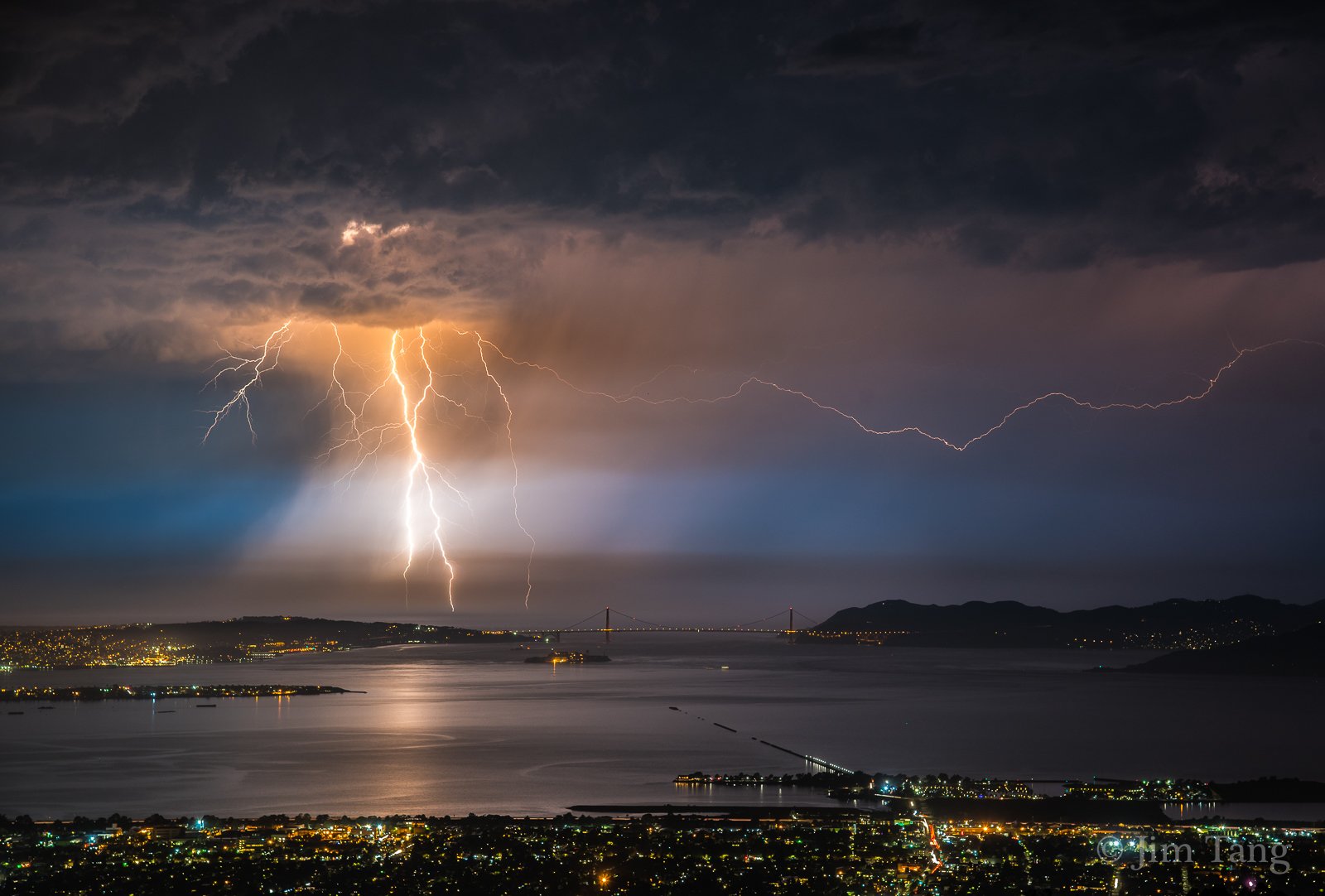
Bay Area gets surprise hit of lightning, thunder and rain
_http://www.sfgate.com/bayarea/article/Bay-Area-gets-surprise-hit-of-lightning-thunder-12190158.php
By Michael Cabanatuan Updated 10:39 pm, Monday, September 11, 2017
In an unusual display of meteorological madness, Mother Nature doused parts of the Bay Area with brief but heavy rain Monday night and zapped some spots with lightning while leaving other areas untouched.
Bay Area sees more than 800 lightning strikes in 5 hours (Vid-0:37 & Tweets)
_http://www.sfgate.com/local/article/Bay-Area-thunder-lightning-rain-storm-weather-SF-12189916.php
By Alix Martichoux, SFGATE Updated 9:03 pm, Monday, September 11, 2017
Snip:
Collapsing thunderstorms cause bizarre isolated winds that whip Bay Area (Calif.) Vid-(0:205)
Updated 3:22 pm, Monday, September 11, 2017
_http://www.sfgate.com/bayarea/article/wind-Bay-Area-Pebble-Beach-meteorologists-baffled-12188308.php
The gusts knocked some communities while others areas were completely still
https://youtu.be/D3oOVJ16OGU
_http://www.sfgate.com/bayarea/article/Bay-Area-gets-surprise-hit-of-lightning-thunder-12190158.php
By Michael Cabanatuan Updated 10:39 pm, Monday, September 11, 2017
In an unusual display of meteorological madness, Mother Nature doused parts of the Bay Area with brief but heavy rain Monday night and zapped some spots with lightning while leaving other areas untouched.
Snip:
A low-pressure front loitering over the Pacific delivered the thunderstorms, which rumbled through the Bay Area starting in the late afternoon or early evening in the South Bay and moving north.
The storms delivered dramatic lightning strikes that started fires, scared pets, and scattered bursts of rain that sent people scurrying to find their umbrellas and stalled the start of a Giants-Dodgers game.
in the Woodside Fire Protection District, said Fire Chief Dan Ghiorso in a text message. Fire crews were handling all of the fires, he said.“Multiple lightning strikes caused multiple fires”
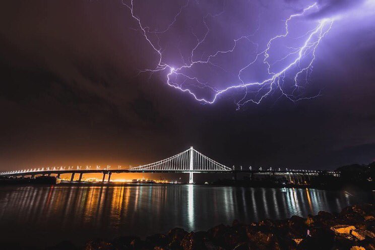
Image 1 of 21
Lighting strike above the eastern span of the Bay Bridge on June, 14, 2017 in San Francisco, Ca.
https://twitter.com/NWSBayArea?ref_src=twsrc%5Etfw&ref_url=http%3A%2F%2Fwww.sfgate.com%2Flocal%2Farticle%2FBay-Area-thunder-lightning-rain-storm-weather-SF-12189916.php
Bay Area sees more than 800 lightning strikes in 5 hours (Vid-0:37 & Tweets)
_http://www.sfgate.com/local/article/Bay-Area-thunder-lightning-rain-storm-weather-SF-12189916.php
By Alix Martichoux, SFGATE Updated 9:03 pm, Monday, September 11, 2017
Snip:
It started with strong wind gusts between 35 and 50 mph that roared through Monterey County and parts of the South Bay in the early morning hours. Later in the day, temperatures climbed to the 90s in San Jose and the high 80s in San Francisco.
Then came the rain, thunder and lightning. The National Weather Service tweeted out that the Bay Area saw more than 800 lightning strikes and cloud flashes between noon and 5 p.m.
By the time thunderstorms bubbled up over parts of the Bay Area Monday afternoon, some people had had enough.
said Twitter user @leahmichon."Feels more like Mexico than Berkeley!"
Collapsing thunderstorms cause bizarre isolated winds that whip Bay Area (Calif.) Vid-(0:205)
Updated 3:22 pm, Monday, September 11, 2017
_http://www.sfgate.com/bayarea/article/wind-Bay-Area-Pebble-Beach-meteorologists-baffled-12188308.php
The gusts knocked some communities while others areas were completely still
Meteorologists are baffled by strong wind gusts that ripped through concentrated pockets of the Bay Area early Monday morning, while other areas remained completely still.
The National Weather Service reports that a gust of 54 mph roared through Pebble Beach at 2:30 a.m., while only 10 minutes away in Monterey conditions remained completely calm.
says Charles Bell, a meteorologist with the National Weather Service Bay Area."We had a very unusual event happen overnight,"The first gusts roared through Pebble Beach and the southwesterly winds traveled north reaching up to 40 mph in Santa Cruz, up to 37 mph in Los Gatos and at the San Jose Airport."We had isolated strong periods of winds. It's really remarkable. Usually wind storms are more widespread, while this wind occurred in concentrated pockets."
The weather service recorded the last gust from the event at 3:30 a.m.; it was a 35 mph wind at the Golden Gate Bridge. Bell says there are anecdotal reports of high winds in parts of Marin.
Thais Derich of Mill Valley wrote on Facebook."We left our window open because of heat and winds were so strong our interior doors were slamming shut and flying open!"
The winds knocked down trees and power lines. PG&E reported 11,000 customers without power at one point.
The event lasted about two hours.
https://youtu.be/D3oOVJ16OGU
I am not sure how you count 40,000 lightning strikes but...
40,000 Lightning Strikes Over SoCal May Indicate Mega-Disaster of Biblical Proportions on the Horizon

https://youtu.be/Qwz-g0_ebdI
40,000 Lightning Strikes Over SoCal May Indicate Mega-Disaster of Biblical Proportions on the Horizon
A volatile storm has ignited a slew of 40,000 lightning strike in southwestern California.
According to zerohedge.com:
The strikes have hit Los Angeles, Santa Barbara, San Luis Obispo, and Ventura counties – all between September 10-11.
The electric storm was most active on Sunday with an amazing 5,000 lightning bolts in the area over a three-hour period. NWS Los Angeles took to Twitter to report the tremendous display. The intense storm brought plenty of lightning to the Golden state’s southern region, but almost no rain. The greatest rain total of .44 inches at Sudden Peak on Sunday. By Monday morning, heavy showers, thunderstorms, and 35-mph winds were reported in eastern Los Angeles County.
But now conspiracy is swirling around this fascinating and unique electric storm. Strange lights and electrons acting oddly seem to have been appearing either before or during major earthquakes – like the recent 8.2 magnitude quake in Mexico. Could these lightning strikes be a sign that California’s mega quake is on the horizon?
https://youtu.be/Qwz-g0_ebdI
Like California, Mexico is a seismically active region that has seen smaller quakes that have caused death and destruction. But Thursday’s temblor is a reminder that even larger quakes — while rare — do occur. Scientists say it’s possible for Southern California to be hit by a magnitude 8.2 earthquake. Such a quake would be far more destructive to the Los Angeles area because the San Andreas fault runs very close to and underneath densely populated areas.
It’s often stated that California is ripe for a devastating mega earthquake and after some noticed the strange lights in the sky above Mexico during its quake, this conspiracy conclusion was an easy one to jump to.
Palinurus
The Living Force
goyacobol said:I am not sure how you count 40,000 lightning strikes but...
Your remark piqued my curiosity so I googled for lightning strikes counters and found out that such devices indeed exist.
And for that matter 40,000 strikes seems small beer considering the over 1 million strikes counted in December 2016 across the south-east of Queensland, Australia:
http://www.couriermail.com.au/news/queensland/incredible-storms-bring-one-million-lightning-strikes/news-story/2bb8a31bbac10005ddf379197a981823?nk=3b761354b912870a9e34973f0fb71ea4-1505589135
OVERNIGHT: More than one million lightning strikes have lit up the southeast Queensland sky so far this summer, as the spectacular storm season continues.
The long run of summer storms is expected to come to an end on Friday, though, after an “uncommon” start to the season.
Energex’s lightning strike counter recorded 1,005,447 hits across southeast Queensland from last Thursday to last night. The recording was before last night’s storm hit.
The mesmerising streaks of lightning across the sky, or cloud-to-cloud lightning, have occurred 842,609 times, while 162,838 bolts have crashed to the ground.
The most strikes, 335,000 of them, occurred last Saturday as monster storm cells swept in from the west.
Palinurus said:goyacobol said:I am not sure how you count 40,000 lightning strikes but...
Your remark piqued my curiosity so I googled for lightning strikes counters and found out that such devices indeed exist.
And for that matter 40,000 strikes seems small beer considering the over 1 million strikes counted in December 2016 across the south-east of Queensland, Australia:
http://www.couriermail.com.au/news/queensland/incredible-storms-bring-one-million-lightning-strikes/news-story/2bb8a31bbac10005ddf379197a981823?nk=3b761354b912870a9e34973f0fb71ea4-1505589135
OVERNIGHT: More than one million lightning strikes have lit up the southeast Queensland sky so far this summer, as the spectacular storm season continues.
The long run of summer storms is expected to come to an end on Friday, though, after an “uncommon” start to the season.
Energex’s lightning strike counter recorded 1,005,447 hits across southeast Queensland from last Thursday to last night. The recording was before last night’s storm hit.
The mesmerising streaks of lightning across the sky, or cloud-to-cloud lightning, have occurred 842,609 times, while 162,838 bolts have crashed to the ground.
The most strikes, 335,000 of them, occurred last Saturday as monster storm cells swept in from the west.
Thanks for finding that Palinurus. It looked too after you found that article.
I found this company selling a small unit Lighning Strike Counter.
One comment in your article "struck" me about the name of a mountain where a man was struck and killed by lightning.
Four people needed treatment after a lightning strike on a Gold Coast house at 4.30pm yesterday. That followed the death of US backpacker Sam Beattie atop Mt Warning on Tuesday morning, after lightning struck the tree his tent was tied to.
Maybe the name is very appropriate. :/
angelburst29
The Living Force
A tropical storm warning has been issued for the southern part of Mexico’s Baja California peninsula as Hurricane Norma approaches with 120kph (75mph) winds.
Tropical storm warning for Baja California as Hurricane Norma nears
https://www.rt.com/usa/403537-hurricane-norma-warning-baja-california/
The US National Hurricane Center said the storm became a hurricane on Friday evening as it swept towards the southern tip of the peninsula in northwestern Mexico.
Mexico’s National Meteorological Service (SMN) issued a warning on Saturday morning, saying the storm will bring rains, strong winds, and a powerful swell, which will affect the west and northwest of the country and the southern part of Baja California.
SMN forecast that the cyclone will slowly move northwards over the next few days, with tropical storm conditions expected to hit the coast on Sunday. The storm is expected to eventually make landfall on September 19.
A tropical storm warning means that tropical storm conditions are expected somewhere within the warning area within 36 hours.
“Norma has been nearly stationary, but a slow northward motion should begin later today and continue through Sunday,”the US National Hurricane Center said.
“Maximum sustained winds are near 75 mph (120 km/h) with higher gusts. Some slight strengthening is possible during the next day or two.”
Norma is currently registering as a Category 1 storm on the Saffir-Simpson scale. Hurricane Irma reached Category 5 status when it wreaked havoc in the Caribbean last week.
Norma reaches hurricane strength near Mexico
http://www.presstv.ir/Detail/2017/09/16/535338/Mexico-Hurricane-Norma
Norma looked likely to churn toward the Los Cabos resort area, according to the US National Hurricane Center in Miami.
At 0300 GMT, Norma was 270 miles (435 km) south of Cabo San Lucas, packing top sustained winds of 75 mph (120 kmph). It was expected to strengthen in coming days the NHC said.
After barreling into Mexico’s Pacific coast as a Category One hurricane, Max was downgraded to a tropical storm Thursday.
That storm, still packing maximum sustained winds of 110 kilometers (70 miles) per hour, was moving inland over southern Mexico at approximately 13 kilometers per hour, according to the US National Hurricane Center.
Situated east of Acapulco, it was expected to weaken and bring “torrential rains” over coastal areas of the southwestern Guerrero state and neighboring Oaxaca, which is still suffering the effects of a massive earthquake last week.
Max has triggered warnings of life-threatening conditions in areas hit by the devastating 8.2 quake, which killed 96 people.
Guerrero state and western parts of Oaxaca state were forecast to receive 12.5 to 25 centimeters (five to 10 inches) of rain, with some areas receiving more than 50 centimeters.
Irma's Aftermath: "For The First Time In 300 Years, There's Not A Single Living Person On Barbuda"
http://www.zerohedge.com/news/2017-09-14/irmas-aftermath-first-time-300-years-theres-not-single-living-person-barbuda
“The damage is complete,” says Ambassador Ronald Sanders, who has served as Antigua and Barbuda’s ambassador to the U.S. since 2015. “For the first time in 300 years, there’s not a single living person on the island of Barbuda — a civilization that has existed on that island for over 300 years has now been extinguished.”
“This was a huge monster,” he says. “The island and the people on the island had absolutely no chance.”
“We’ve had most of the people we’ve brought over to Antigua in shelters,” says Sanders. “We’ve tried to make living accommodations as good as humanly possible in these circumstances. Fortunately, we had planned ahead for this hurricane, and we had ordered supplies in from Miami and the United States before the hurricane hit.”
Tropical storm warning for Baja California as Hurricane Norma nears
https://www.rt.com/usa/403537-hurricane-norma-warning-baja-california/
The US National Hurricane Center said the storm became a hurricane on Friday evening as it swept towards the southern tip of the peninsula in northwestern Mexico.
Mexico’s National Meteorological Service (SMN) issued a warning on Saturday morning, saying the storm will bring rains, strong winds, and a powerful swell, which will affect the west and northwest of the country and the southern part of Baja California.
SMN forecast that the cyclone will slowly move northwards over the next few days, with tropical storm conditions expected to hit the coast on Sunday. The storm is expected to eventually make landfall on September 19.
A tropical storm warning means that tropical storm conditions are expected somewhere within the warning area within 36 hours.
“Norma has been nearly stationary, but a slow northward motion should begin later today and continue through Sunday,”the US National Hurricane Center said.
“Maximum sustained winds are near 75 mph (120 km/h) with higher gusts. Some slight strengthening is possible during the next day or two.”
Norma is currently registering as a Category 1 storm on the Saffir-Simpson scale. Hurricane Irma reached Category 5 status when it wreaked havoc in the Caribbean last week.
Tropical Storm Norma surged to hurricane strength late Friday off Mexico’s Pacific coast which was pounded just hours earlier by Tropical Storm Max.
Norma reaches hurricane strength near Mexico
http://www.presstv.ir/Detail/2017/09/16/535338/Mexico-Hurricane-Norma
Norma looked likely to churn toward the Los Cabos resort area, according to the US National Hurricane Center in Miami.
At 0300 GMT, Norma was 270 miles (435 km) south of Cabo San Lucas, packing top sustained winds of 75 mph (120 kmph). It was expected to strengthen in coming days the NHC said.
After barreling into Mexico’s Pacific coast as a Category One hurricane, Max was downgraded to a tropical storm Thursday.
That storm, still packing maximum sustained winds of 110 kilometers (70 miles) per hour, was moving inland over southern Mexico at approximately 13 kilometers per hour, according to the US National Hurricane Center.
Situated east of Acapulco, it was expected to weaken and bring “torrential rains” over coastal areas of the southwestern Guerrero state and neighboring Oaxaca, which is still suffering the effects of a massive earthquake last week.
Max has triggered warnings of life-threatening conditions in areas hit by the devastating 8.2 quake, which killed 96 people.
Guerrero state and western parts of Oaxaca state were forecast to receive 12.5 to 25 centimeters (five to 10 inches) of rain, with some areas receiving more than 50 centimeters.
I wonder, how Hurricane Norma will affect the San Diego area?
After 15 die in hepatitis outbreak, San Diego begins sanitary street washing
http://www.msn.com/en-us/news/us/after-15-die-in-hepatitis-outbreak-san-diego-begins-sanitary-street-washing/ar-AArHP3N?page=10
Sanitary street washing will commence in downtown San Diego and will continue every other week to combat the city’s deadly hepatitis A outbreak, Mayor Kevin Faulconer’s office said Friday.
The city responded to a letter sent by San Diego County Thursday, asking the city to move forward with a list of specific sanitation actions designed to help control the spread of the disease, which has killed 15 people and hospitalized nearly 300, many of them homeless and living on streets without adequate access to restrooms or showers.
The county gave the city five business days to respond with a plan for remedying what it called a “fecally contaminated environment” downtown. The county will soon expand its efforts to other cities in the region, where the outbreak has now produced nearly 400 confirmed cases.
The county moved forward last weekend with its own contractor, who installed 40 hand-washing stations in areas where the homeless often gather. There are plans, according to the city’s letter, to add more stations next week.
In addition to regularly pressure-washing dirty city right-of-ways with chlorinated water, the county also asked the city to “immediately expand access to public restrooms and wash stations within the city limits that are adjacent to at-risk populations.”
Exactly one week ago, Prime Minister Gaston Browne surveyed the damage on his tiny Caribbean island of Barbuda and declared that Hurricane Irma had completely devastated the island and left 90% of all dwellings leveled. Browne went on to say that Irma's "absolute devastation" meant that Barbuda was "basically uninhabitable" for the 1,800 people who called it home.
Irma's Aftermath: "For The First Time In 300 Years, There's Not A Single Living Person On Barbuda"
http://www.zerohedge.com/news/2017-09-14/irmas-aftermath-first-time-300-years-theres-not-single-living-person-barbuda
“The damage is complete,” says Ambassador Ronald Sanders, who has served as Antigua and Barbuda’s ambassador to the U.S. since 2015. “For the first time in 300 years, there’s not a single living person on the island of Barbuda — a civilization that has existed on that island for over 300 years has now been extinguished.”
“This was a huge monster,” he says. “The island and the people on the island had absolutely no chance.”
“We’ve had most of the people we’ve brought over to Antigua in shelters,” says Sanders. “We’ve tried to make living accommodations as good as humanly possible in these circumstances. Fortunately, we had planned ahead for this hurricane, and we had ordered supplies in from Miami and the United States before the hurricane hit.”
angelburst29
The Living Force
Hurricane Maria is forecast to rapidly strengthen over the next two days as it takes aim at Caribbean islands devastated by Hurricane Irma just days ago.
Hurricane Maria Is Following Irma’s Path and Getting Stronger
CNN Wire http://wnep.com/2017/09/18/hurricane-maria-is-following-irmas-path-and-getting-stronger/
The storm is expected to be a major hurricane when it hits the Leeward Islands over the next few days, intensifying to a Category 4 hurricane in 48 hours, according to the National Hurricane Center’s latest update.
As of Sunday at 11 p.m. ET, Maria was about 100 miles (165 kilometers) northeast of Barbados and about 210 miles (340 kilometers) east-southeast of Dominica, the center said. It had strengthened into a Category 1 hurricane with winds of 85 mph and is forecast to continue moving toward the eastern Caribbean at 13 mph.
“Maria continues to strengthen and is expected to be at major hurricane intensity when it affects portions of the Leeward Islands over the next few days, bringing dangerous wind, storm surge and rainfall hazards,” the hurricane center said.
Maria is one of three storms churning in the Atlantic Ocean, but it poses the most danger to the hurricane-battered Caribbean.
Maria has prompted a hurricane warning for Martinique, Guadeloupe, Dominica, St. Kitts, Nevis, and Montserrat. A tropical storm warning is in effect for Antigua and Barbuda, Saba, St. Eustatius and St. Lucia. A warning is typically issued 36 hours before the anticipated first occurrence of tropical-storm-force winds.
The warning means that tropical storm conditions are expected within 36 hours.
A hurricane watch is in effect for the US Virgin Islands, the British Virgin Islands, St. Maarten/St. Martin, St. Barthelemy and Anguilla — many of which were devastated when Irma blew through the Caribbean, killing 44 people. A hurricane watch is typically issued 48 hours before the anticipated first occurrence of tropical-storm-force winds.
“Maria is likely to affect the British and US Virgin Islands and Puerto Rico by midweek as a dangerous major hurricane,” the NHC said.
Torrential rainfall could cause deadly flash flooding and mudslides. Maria could dump 6 to 12 inches of rain across the Leeward Islands — including Puerto Rico, the US Virgin Islands, and the British Virgin Islands — through Wednesday night.
Hurricane Jose
Meanwhile, Hurricane Jose is maintaining its intensity as it churns north, threatening “dangerous surf and rip currents” along the US East Coast in the next few days, the hurricane center said.
Late Sunday, the Category 1 hurricane was about 305 miles (490 kilometers) southeast of Cape Hatteras, North Carolina, and moving north at 9 mph. While the center of Jose is expected to stay off from the US East Coast, “swells generated by Jose are affecting Bermuda, the Bahamas, and much of the US east coast,” the NHC said.
“These swells are likely to cause dangerous surf and rip current conditions for the next several days in these areas.”
The hurricane center said that Jose would produce heavy rain as it passes near southern New England and the mid-Atlantic on Tuesday and Wednesday, but that based on current forecasting the risk of flooding would be “limited in scope.”
Tropical Depression Lee
Lee, the third storm in the Atlantic, fizzled from a tropical storm to a tropical depression Sunday, the hurricane center said.
As of Sunday night, the storm was about 980 miles west of the Cabo Verde Islands.
Lee’s maximum sustained winds have sputtered to 35 mph, and are expected to further weaken in the coming days.
angelburst29
The Living Force
Snow fell in Sierra Nevada on the last day of summer, giving the towering mountain range shared by California and Nevada a wintry look in September and making travel hazardous.
'It’s kind of a weather roller coaster': On last day of summer, California hit by snow, hail (Video)
http://www.latimes.com/local/lanow/la-me-california-snow-20170921-story.html
Mammoth Lakes got more than a dusting Thursday in the first snowfall of the season, with 3 inches reported in the village. Snow coated the roads so heavily that the plows were out, and locals left footprints on sidewalks.
Sixteen vehicles crashed on Interstate 80 as snow and hail fell Thursday, killing a man driving a pickup and causing minor injuries to other people, California Highway Patrol Officer Chris Nave said.
Snow dusted peaks in Yosemite National Park and temporarily closed Tioga Pass road, the soaring eastern entry to the park that typically doesn’t become impassable until mid-November.
Several inches of snow were expected at elevations of at least 6,000 feet in the northern Sierra, National Weather Service forecaster Hannah Chandler said in Sacramento.
Puerto Rico: No Power, No Phones, And "Unprecedented" Damage
http://www.zerohedge.com/news/2017-09-22/puerto-rico-no-power-no-phones-and-unprecedented-damage
More than 95% of Puerto Rico’s wireless cell sites are currently out of service, according to the FCC. That is worse than the aftermath of Hurricane Irma, which knocked out 56% of the island’s wireless network. Federal Emergency Management Agency Administrator Brock Long said restoring electricity to the island “could take weeks or many, many months.”
But the damage goes beyond cell towers. The most powerful hurricane to hit the US territory in almost a century hobbled the island's telecommunications system, destroyed its power grid and left communities facing widespread devastation. Puerto Rican authorities have warned the island’s 3.4 million residents that the island faces a difficult and expensive path to recovery from Maria. As the territory rushes to provide initial relief to its struggling citizens, Abner Gómez, executive director of the island’s emergency-management agency, said residents should be prepared to sustain themselves without aid for 72 hours, given the severity of the damage, the obstacles to reach people and how thinly stretched government resources are.
FCC Chairman Ajit Pai said the agency is working with telecom providers to help get the communications networks back online. About a week after Irma hit, all but 6% of Puerto Rico’s cell sites were back online.
Unfortunately, getting Puerto Rico’s communications networks up and running will be a challenging process, particularly given the power outages,” Mr. Pai said.
In an interview aired on the only radio station left that could still broadcast across the island, PR Gov. Ricardo Rosselló described the situation on the island as a crisis. Flooding and mudslides are a “giant problem” especially in rural, mountainous areas, he said, adding that damage to the island’s infrastructure was enormous and the cost to fix it will be “humongous.”
'It’s kind of a weather roller coaster': On last day of summer, California hit by snow, hail (Video)
http://www.latimes.com/local/lanow/la-me-california-snow-20170921-story.html
Mammoth Lakes got more than a dusting Thursday in the first snowfall of the season, with 3 inches reported in the village. Snow coated the roads so heavily that the plows were out, and locals left footprints on sidewalks.
Sixteen vehicles crashed on Interstate 80 as snow and hail fell Thursday, killing a man driving a pickup and causing minor injuries to other people, California Highway Patrol Officer Chris Nave said.
Snow dusted peaks in Yosemite National Park and temporarily closed Tioga Pass road, the soaring eastern entry to the park that typically doesn’t become impassable until mid-November.
Several inches of snow were expected at elevations of at least 6,000 feet in the northern Sierra, National Weather Service forecaster Hannah Chandler said in Sacramento.
Hurricane Maria has moved on from Puerto Rico and was passing the Turks and Caicos Islands Friday morning as a Category 3 storm. But the devastation it caused will disrupt life on the island for the next six months, possibly longer, as the cash-strapped US territory struggles to rebuild its power grid and other crucial infrastructure that was completely destroyed by the storm, according to a report in the Wall Street Journal.
Puerto Rico: No Power, No Phones, And "Unprecedented" Damage
http://www.zerohedge.com/news/2017-09-22/puerto-rico-no-power-no-phones-and-unprecedented-damage
More than 95% of Puerto Rico’s wireless cell sites are currently out of service, according to the FCC. That is worse than the aftermath of Hurricane Irma, which knocked out 56% of the island’s wireless network. Federal Emergency Management Agency Administrator Brock Long said restoring electricity to the island “could take weeks or many, many months.”
But the damage goes beyond cell towers. The most powerful hurricane to hit the US territory in almost a century hobbled the island's telecommunications system, destroyed its power grid and left communities facing widespread devastation. Puerto Rican authorities have warned the island’s 3.4 million residents that the island faces a difficult and expensive path to recovery from Maria. As the territory rushes to provide initial relief to its struggling citizens, Abner Gómez, executive director of the island’s emergency-management agency, said residents should be prepared to sustain themselves without aid for 72 hours, given the severity of the damage, the obstacles to reach people and how thinly stretched government resources are.
FCC Chairman Ajit Pai said the agency is working with telecom providers to help get the communications networks back online. About a week after Irma hit, all but 6% of Puerto Rico’s cell sites were back online.
Unfortunately, getting Puerto Rico’s communications networks up and running will be a challenging process, particularly given the power outages,” Mr. Pai said.
In an interview aired on the only radio station left that could still broadcast across the island, PR Gov. Ricardo Rosselló described the situation on the island as a crisis. Flooding and mudslides are a “giant problem” especially in rural, mountainous areas, he said, adding that damage to the island’s infrastructure was enormous and the cost to fix it will be “humongous.”
angelburst29
The Living Force
angelburst29 said:c.a. said:The Vulture's never miss a beat.
<snip>
Presidents Obama, Bush, & Clinton: Help for Haiti (14:25)
The Obama White House Published on Jan 16, 2010
https://youtu.be/jta-4JLawYI
Five ex-US presidents join forces to support Harvey victims
https://www.aol.com/article/news/2017/09/07/five-ex-us-presidents-join-forces-to-support-harvey-victims/23201075/
The presidents will launch “One America Appeal,” to start collecting funds with a plea broadcast during Thursday night’s National Football League season opener, the group said in a statement. Former presidents Barack Obama, George W. Bush, Bill Clinton, George H.W. Bush and Jimmy Carter are behind the effort.
On Saturday night, all of the five living former US presidents, without current POTUS Donald Trump, will attend a disaster relief event in the city of Austin, Texas.
'Unprecedented': Five Living US Presidents to Attend Disaster Relief Concert
https://sputniknews.com/us/201710211058438227-five-us-presidents-attend-concert/
In an effort to raise money for disaster relief in the wake of Hurricane Harvey, Irma and Maria and the destruction the three storms caused in Texas, Florida, Puerto Rico and the US Virgin Islands, former US Presidents Barack Obama, George W. Bush, Bill Clinton, George H.W. Bush and Jimmy Carter will make an unprecedented group by convening in the Texas capital for the concert.
Speeding north at almost 20 mph, Super Typhoon Lan, packing 150-mph sustained winds and 184-mph gusts, is scheduled to strike Japan’s largest metropolis at about 6 a.m. local time on Monday.
Super Typhoon Lan to Make Direct Hit on Tokyo
https://sputniknews.com/asia/201710221058438930-typhoon-lan-to-hit-tokyo/
Officials have been placed on high alert as schools and some travel corridors are expected to be closed on Monday as the dangerous Category 4 storm is expected to bring heavy rains, wind-related damage and a destructive tidal surge to the region.
Currently some 300 miles east of Japan, super-typhoon Lan forecasts warn of landslides and flash flooding inland around the Tokyo metropolitan area, home to some 38 million people, or about 30 percent of the nation‘s population.
Local elections in Japan's southern island region of Okinawa were moved up in expectation of the storm's effect on travel and infrastructure, cited by Quartz.
Due to the size of the storm and its projected position, insurance damage estimates are expected to top $25 billion, a figure much lower than those following similar hurricane strikes on the US mainland.
The lower insurance projections are noted to be a result of superior disaster preparedness on the part of the island nation, according to Bloomberg.